Hurricane-force winds struck Wichita for the second time in two weeks Thursday night, knocking out power in parts of the metropolitan area and stripping trees of limbs and branches.
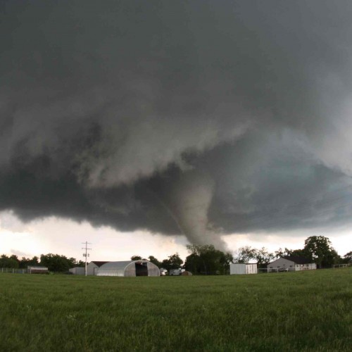
The line of storms produced a brief tornado in Kingman County, hail as large as tennis balls in Reno County and straight-line winds ranging between 60 and 85 miles an hour, according to the National Weather Service.
Widespread tree damage was reported in Mount Hope, where winds estimated at 80 miles an hour were reported.
“There were trees twisted and split in Mount Hope,” National Weather Service meteorologist Jaclyn Ritzman said Friday. “There was a lot of tree damage.”
Limbs and large branches were reported down throughout the northwest Sedgwick County town.
A tornado touched down at 8:16 p.m. seven miles east of Cunningham in Kingman County. Trees were damaged near the Kingman State Lake, National Weather Service meteorologist Jim Caruso said, but otherwise “there was really nothing of consequence.”
The weather service did not send a damage survey team to Kingman County because the damage was so minor.
Thousands of Westar Energy customers lost electricity in the metropolitan area as a result of the storms. That number still topped 300 by late Friday afternoon, with Westar officials predicting power would be restored later in the day.
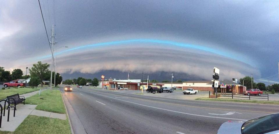
The hurricane-force winds arrived with a front that moved through the area Thursday night. The front’s arrival was announced by a well-developed shelf cloud that prompted fear and awe among area residents.
“It was scary looking … that’s for sure,” Ritzman said.
Numerous house and building fires were reported late Thursday night and early Friday morning from lightning strikes, officials said. One of those fires was a two-alarm blaze at the Western Holiday Motel, 8925 W. Kellogg.
Wichita Fire Battalion Chief Sid Newby said that during the storm Thursday evening, firefighters received calls for “numerous lightning strikes, house fires,” spreading firefighters throughout town.
The first crew to arrive at the hotel at about 9 p.m. saw flame and smoke coming from the attic, he said. No one was in the affected room.
The building was evacuated, and that fire crew had to work it solo until more firefighters could be called to the scene, Newby said.
Thursday was the second time in two weeks that Wichita endured hurricane-force winds. The weather service clocked winds of 80 miles an hour on July 14, and winds of 75 miles an hour were logged in west Wichita.
The same part of town reported winds of 75 to 85 miles an hour Thursday night.
“We just seem to be getting a lot of the wind this month,” Ritzman said.
A lot of rain, too: The rain that fell Thursday night and Friday morning amounted to 1.09 inches, lifting Wichita’s total for the month to 9.63 inches. That’s the second-wettest July on record, topped only by the 13.37 inches recorded in 1950.
More rain is possible early Saturday, forecasters say.
By: Stan Finger JULY 29, 2016 8:34 AM
Photo: By Travis Heying The Wichita Eagle “A shelf cloud forms Thursday evening near Central and West streets in Wichita.”