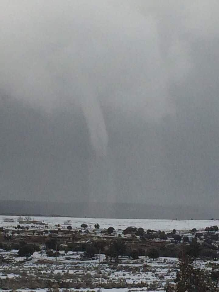
Antonio Chiquito was having a relatively normal winter day in Tinian, N.M., on Feb. 17. Temperatures were about 30 degrees, with heavy snow showers, and nothing seemed too out of the ordinary. And then he spotted a tornado — made out of snow.
“I had been at church, and then I came home and took the sheep out,” recalled Chiquito, who lives on the eastern end of the Navajo Nation. “When I was heading inside to warm up, I glanced up and saw the funnel cloud.”
Sure enough, Chiquito’s suspicions were correct: It was a tornado. At first, he was a little frightened, but surprisingly not shocked. He had seen twisters in Tinian before but never following a snow squall.
Tornadoes require lift and rotation to form. It’s nearly impossible to get pockets of air to rise quickly enough for tornado-genesis in environments also supportive of snow. Temperatures at or below freezing near the ground usually come with a stable atmosphere — not one that could spin up a tornado.
Glancing at weather balloon data from nearby Albuquerque, there is nothing supporting the type of updrafts needed to produce a supercell, the kind of rotating thunderstorm that can spawn a tornado. Little wind shear — rotational energy — is present. It hardly even looks moist enough to snow.
But radar data and eyewitness accounts tell a different story. That means the tornado was likely partially mechanic — meaning that it formed due in part to surface or topographic influences, rather than entirely from cloud-based rotation.
Radar does show a potent snow shower that bubbled up to 17,000 feet. That’s not overly impressive for a thunderstorm, but it is a high altitude for a snow squall. And it appears to have formed along some type of weather boundary, likely feeding off the wind shift and taking on some rotation. Indeed, the storm exhibits weak rotation, likely stronger below the radar beam.
The National Weather Service in Albuquerque concurs, confirming the funnel as a landspout, which is a tornado that forms from the ground up rather than one that descends from spinning clouds above.
“We had a little bit of a winter system that came through during that time,” said Sharon Sullivan, a meteorologist at the Albuquerque Weather Service office. “It looked to us to be two different colliding outflow boundaries that helped stir up this updraft. It wasn’t really anything convective.”
An outflow boundary is the leading edge of cool air descending from a precipitating cloud. When two boundaries meet, their respective air masses intermingle, generating turbulent eddies. On occasion, one of these ground-based swirls can be stretched up to the cloud base when it becomes entrained in a developing cloud’s updraft. That looks to have been the case last week.
“It’s one of only three winter tornadoes on record in New Mexico,” according to Sullivan, “and the first in February.” Both of the other winter tornadoes came from rain clouds, not snow.
This may, in fact, be a one-of-a-kind occurrence documented in the United States. There aren’t any bona fide examples of a tornado whirling as snow falls simultaneously. There are rumors that one may have snaked its way down from a snow squall near Whitefish Bay, Wis., in 1987, but there doesn’t seem to be any literature available to support that.
Winter waterspouts can occasionally form beneath snow showers but tend to be much weaker — on the order of 30 to 40 mph. Plus they feed off relatively warm water when arctic air masses pass overhead.
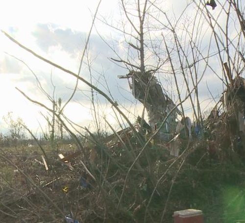
As no damage was reported, the Weather Service has no plans to investigate further.
by Matthew Cappucci (2019, Feb 27) The Washington Post