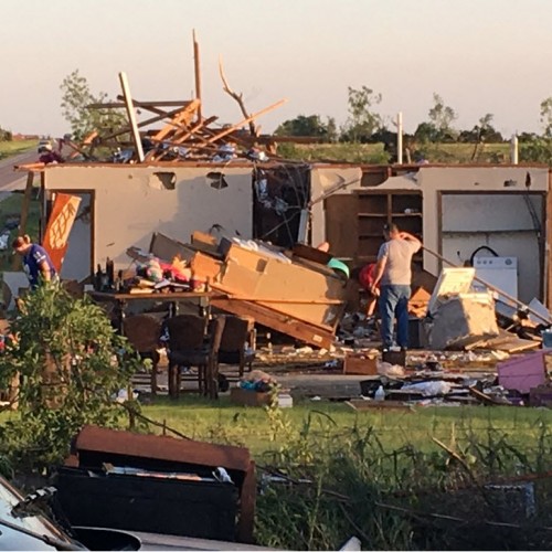
The National Weather Service confirms that a high end EF-1 tornado raced through Daviess County Saturday around 4 p.m.
It damaged at least ten homes, smashed cars and toppled dozens of trees.
“Part of it’s sad and part is thinking how lucky we were,” said Sharon Carter whose home and trees were damaged by the tornado.
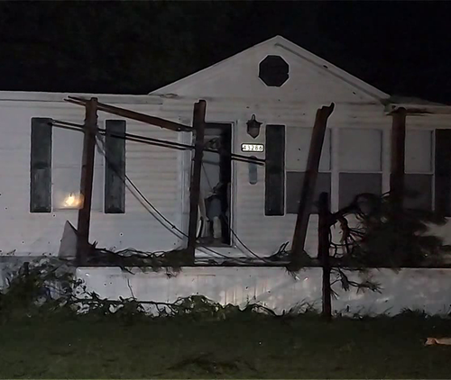
As the sun rose Sunday, realization set in for folks in Stanley.
“Just walking around this morning, seeing a lot of things we didn’t see yesterday still cause the first thing when I got up this morning and looked outside I just started bawling,” said Carter.
The National Weather Service, Daviess and Henderson County EMA starting their assessments not even 24 hours later.
“It’s a very high end EF-1 from the damage indicators,” said Kelly Hooper with the National Weather Service.
The path was just over two miles long with winds reaching around 110 mph.
“You got trees snapped which is really the biggest indicator of the wind speed because they’re very easy to read,” said Hooper.
Officials say the tornado formed from a combination of the hurricane and a cold front. Trees, debris and everything in between still lie scattered in front yards and backyards.
“Everybody comes together, pulls together, makes it through it and that’s what you like to see. The best thing about all this is we had no reported injuries so we’re very thankful for that,” said Daviess County EMA director Andy Ball.
“I’m glad no one was hurt, all this can be replaced, lives can’t. So it’s a good thing no one was hurt. I go to so many where they are,” said Hooper.
A handful of families are displaced, but now safe in temporary homes.
“There’s always been the threats and stuff but not anything like that, it was really scary,” said Carter.
by Amelia Young (2018, September 9) Tristate Home Page