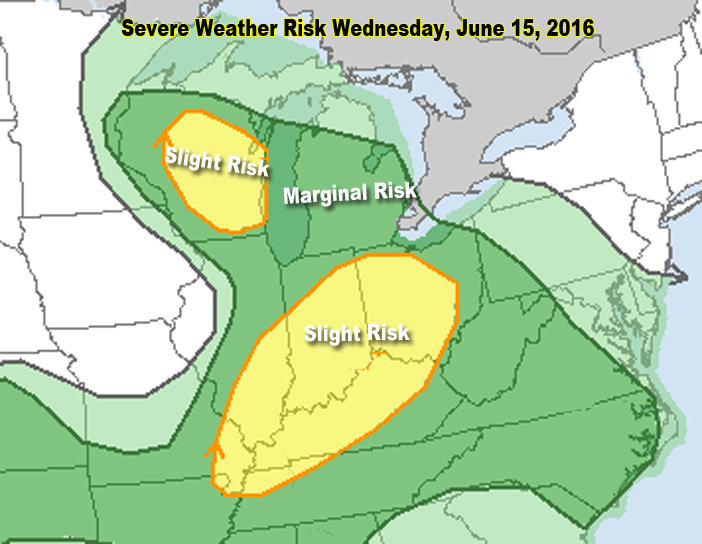
Michigan’s severe weather threat continues to lessen with every round of new data.
The light thunderstorms that moved through this morning have left lots of lingering clouds. The clouds will keep the temperatures down and keep severe weather to a minimum.
There is still a chance of severe storms in Michigan within the next 24 hours. I feel the main threat is overnight tonight and very early Thursday morning. The National Weather Service in Grand Rapids agrees the dynamics to drive severe weather will be most powerful over Michigan overnight tonight.
And overnight severe weather has a lesser chance of happening, due to a cooler, more stable atmosphere.
The latest shows a fairly significant chance of isolated tornadoes just west of Lower Michigan. The Storm Prediction Center puts part of eastern Wisconsin in a five percent chance of a tornado within 25 miles of a given point. I know five percent sounds low, but it’s actually a much increased chance of a tornado compared to the chances on a normal day.
For Michigan, the chance of a tornado has been removed as of 7:45 a.m. this morning. A new update will come after 12:30 p.m.
Thunderstorms this afternoon could produce an isolated swath of high wind gusts or large hail. The thunderstorms, however, will actually be very isolated this afternoon.
In the evening, more potent thunderstorms will likely develop, and continue overnight.
So, if you are like me and have wimpy dogs afraid of thunder, you may have dogs in your bed tonight.
I’ll keep you updated if something changes dramatically this evening.
Photo By: Mark Torregrossa
By Mark Torregrossa | mtorregr@mlive.com
on June 15, 2016 at 11:38 AM, updated June 15, 2016 at 12:08 PM