In an era of high-tech radar, high-speed internet and aggressive weather coverage online and on television, it’s rare for anyone paying attention to be caught off-guard by a life-threatening storm. But one small East Texas town was hit by a life-threatening tornado Sunday without any advance notice – and there’s nothing to stop it from happening again.
No Watch, No Warning
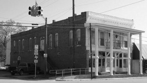
Lovelady, Texas, is the quintessential American small town – 600 residents and one traffic light, the kind that forever blinks yellow for passers-through on Highway 19, and red for cross traffic on the local farm-to-market road.
Sunday, April 13, 2014, was a muggy afternoon in this quiet Houston County burg, 95 miles north of the city of Houston. Occasionally a shower passed by. The town was near the southern lip of a “slight risk” severe weather outlook issued by the Storm Prediction Center in Norman, Okla., suggesting that hailstorms and strong wind gusts were possible sometime Sunday or Sunday night, with a 2 percent chance of a tornado within 25 miles of town.
But as the hours wore on, thunder and lightning seemed determined to stay away, and all tornado watches and warnings were for storms over 100 miles to the north. One boomer passed through the county around 3:15 p.m., but it was too far away for Lovelady residents to hear anything even over the quiet of the surrounding pastures.
Then, out of nowhere, chaos struck.
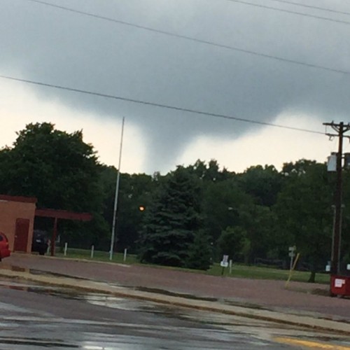
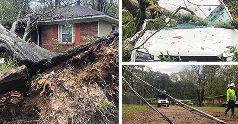
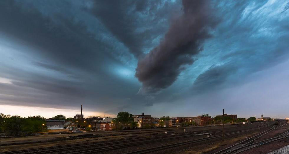
Sometime between 4:30 and 5 o’clock, a tornado spun up on the west side of town, within spitting distance of the town’s traffic light. In an instant, at least two large trees were pulled from the ground, smashing into the dining room of Toni Cowger’s mobile home. She had just left the dining table to peek outside at the wind-whipped commotion – and escaped with a cut leg.
At the same time, Esther Ramirez’s mobile home was shoved off its foundation and mangled by the twister. Ramirez, who is battling cancer, had left 45 minutes earlier to spend the evening with her son. She was unhurt.
Within two minutes, the tornado zipped three-quarters of a mile north to Lovelady High School, causing some cosmetic damage, and then disappeared.
Confusion and Clues
Information about the tornado in Lovelady was slow to reach the outside world.
For several hours, discussion percolated in the National Weather Service’s private chat room, limited to meteorologists, emergency managers and members of the media.
Skepticism reigned. Photographs and videos of damage – and even of a tornado – had surfaced on the internet, but radar didn’t show anything even remotely resembling a storm capable of unleashing such chaos. Furthermore, there were conflicting reports about the timing of the twister – reports normally resolved by matching damage areas to radar signatures.
Meteorologist Patrick Blood was on duty Sunday at the National Weather Service office in League City, Texas, near Houston. With conflicting reports from the scene and a lack of detailed information from the Houston County Sheriff’s Office, Blood had to take an educated guess at when the tornado may have occurred.
Blood issued his first preliminary local storm report on the Lovelady tornado at 9:11 p.m. CDT, and filled in an event time of 3:00 p.m.
“Once we started discussing this more with the [Houston County] emergency manager and witnesses on the ground, it was closer to 5. So my WCM [warning coordination meteorologist] asked me to update that [storm report] with 5:00,” Blood said. “Folks that were directly involved said it was likely a little before 5.”
The following day, a National Weather Service survey crew determined that the Lovelady tornado rated an EF1 on the Enhanced Fujita Scale, with estimated maximum winds of 100 miles per hour based on the uprooted trees and damage to the mobile homes. The agency’s survey report estimated a touchdown time of 4:45 p.m.
The added information only deepened the meteorological mystery. Radar at the time showed a weak eastbound shower passing south of Lovelady – but the tornado struck the town and moved north. Meteorologists at The Weather Channel speculated that the dying rain shower may have produced a localized downburst of wind that was mistaken for a tornado.
But video evidence pointed to an actual tornado. “When we saw the video, the tornado is impressive. It was definitely not doctored,” Blood said. “When we saw the pictures, we were like, ‘Wow.’”
If the tornado wasn’t doctored, that meant a damaging tornado struck without showing any clear evidence of itself on radar, in an area where no severe weather warnings or even watches were in effect. How could that happen?
The East Texas Radar Hole
As it turns out, Lovelady sits in a blind spot in the nation’s radar network.
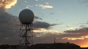
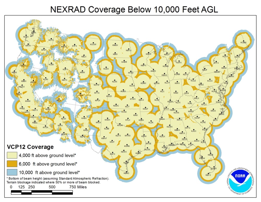
NEXRAD is the network of 160 high-resolution Doppler radars operated by the National Weather Service, part of the National Oceanic and Atmospheric Administration.
 The network has proven invaluable in improving warnings for life-threatening weather – and in particular, for tornadoes. The radars’ ability to detect the motion of precipitation within storms gives forecasters the ability to spot areas of likely tornado development, even if a tornado hasn’t yet formed or been visually confirmed by ground spotters.
But a tornado, by definition, is a violently rotating column of air in contact with the ground. Doppler radar, by nature, detects precipitation and motion in the air above the ground.
To get a three-dimensional picture, the NEXRAD radars send out beams at various angles above the horizon, with the lowest beam angled half a degree above the horizontal. As that radar beam travels farther from the radar installation, it climbs farther above the ground – and the earth’s curvature adds to this gain in altitude.
By the time the lowest-angled radar beam from League City reaches Lovelady, it has traveled 115 miles – and is over 12,000 feet above the earth’s surface. This means anything happening in the atmosphere below 12,000 feet cannot be detected by the radar.
Unfortunately for residents of Lovelady and Houston County, all the surrounding radars in the NEXRAD network are just as far away. The radar at Granger, near Austin, is about 120 miles away. There are three radars in western Louisiana but those are even farther away.
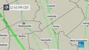
Making matters worse, the League City radar has been plagued recently by what Blood called “telecommunications spikes,” resulting in erroneous radar returns, at times aligned right over Lovelady.
Blood, the NWS meteorologist, believes that the Lovelady tornado was the result of two microscale wind shift boundaries originating from nearby shower activity.
“It probably formed right there, moved .78 miles, and it was done. It was probably one weak gust front from one shower intersecting with another,” Blood said.
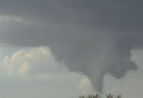
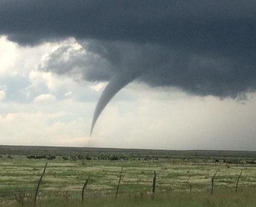
The intersecting gust fronts caused an area of rising, spinning air to form. In a dry environment, this might have kicked up a dust devil. But in the very muggy air over Lovelady, a visible funnel cloud formed instead. This kind of tornado is known as a landspout.
Most tornadoes originate from powerful thunderstorms that tower tens of thousands of feet into the air. But this landspout wasn’t associated with a thunderstorm; there were no reports of thunder or lightning near the tornado. All the action was in the lowest part of the atmosphere, well below all the radar beams crisscrossing Lovelady from afar.
“I’ve never seen a thunderstorm below 12,000 feet,” Blood noted. “It was likely a glorified landspout – we’re calling it a tornado, [but] it was a strong landspout.”
Blood said there is “no way we would have been able to warn” residents of this tornado because of the way it formed and its distance from the nearest Doppler radar. And in the unlikely event this were to happen again in Houston County?
“If this were to happen again, same thing,” Blood cautioned. “You’re not going to warn on a shower.”
Vulnerable in Tornado Alley
In spite of modern technology, about 25 percent of tornadoes in the U.S. occur without a tornado warning in place.
However, many of those occur within severe thunderstorm warnings or tornado watches. Relatively few tornadoes develop without any kind of watch or warning in place ahead of time, as the Lovelady tornado did.
Landspouts of the strength that struck Lovelady Sunday are quite unusual. “I would think it’s about as strong as [a landspout] would get,” Blood said.
And even when landspouts form, not every city or town is taken by surprise in the same way. Blood pointed out that the same kind of landspout could hit downtown Houston or downtown Dallas and “blow out lots of windows” – but since those cities are very close to the powerful NEXRAD radars, the radar beams would be more likely to detect some sign of their existence.
Blood said that if another surprise tornado like this were to happen, “it’s gonna be in an area where the radar beam is at 12,000 feet.”
There are several tornado-prone areas where similar gaps in NOAA’s radar network exist. Notably, none of them are near major metropolitan areas. Instead, the most vulnerable Americans in the Plains and Dixie tornado alleys are those who live in rural areas and smaller towns far from major urban centers. Many of these areas also happen to have relatively high poverty rates.
A 2009 analysis of the NEXRAD network mapped by W. Scott Lincoln, now a National Weather Service hydrologist and cartographer, showed areas of the country poorly served by the existing arrangement of radars. (Since then, one radar has been added on the Pacific coast of Washington.)
Houston County is the epicenter of a gap where the lowest radar beams are a lofty 14,000 feet above ground. Another area of Texas around Paris and across the river into Oklahoma is in an equally blind spot.
An arc from northeast Louisiana through southeast Arkansas and northwest Mississippi is also in a radar no-man’s-land. Similar gaps affect areas near Poplar Bluff in southeast Missouri, Kirksville in northeast Missouri, Mason City in northern Iowa, and a long zone in northern and western Minnesota.
Even the classic Plains tornado alley has gaps in near-ground radar coverage. These include South Dakota’s capital city, Pierre, a large part of the Nebraska Panhandle, and a zone near the border between the Texas Panhandle and Oklahoma.
Blood said his National Weather Service branch emphasizes the radar gap during its severe weather training sessions in Houston County.
“What we try to do is educate the public more, focus on SKYWARN more,” Blood said, referring to the bureau’s volunteer severe weather spotter program.
“You have to explain that the radar beam is well above the ground and that eyes on the ground are important,” he emphasized. “We focus on Houston County because they are in that sort of no-man’s zone in terms of the radar.”
Is There a Solution?
The prospects for any additional NEXRAD radars being established are slim. After the original buildout of the $1 billion system in the 1990s, only one new radar has been added to the network in the last 10 years.
However, ongoing research may offer an affordable solution to filling gaps in the nation’s radar network.
The Engineering Research Center for Collaborative Adaptive Sensing of the Atmosphere, CASA, has been testing several arrays of smaller, less expensive Doppler radars. The aim is to cover more of the near-ground environment with radar – something the current network of powerful but broadly-spaced radars cannot do.
According to CASA’s website, current test projects include a radar in western Massachusetts to fill a gap between NEXRAD radars near Boston and Albany, N.Y., and a network of closely-spaced radars that will provide dense, high-resolution, rapidly-updating urban radar coverage in the Dallas-Fort Worth Metroplex beginning this spring.
The consortium claims its six-year test project in southwest Oklahoma, which ended in 2011, saved lives when a tornado suddenly changed course before more distant NEXRAD radar could detect it.
Such radars, if deployed to areas farther from the existing NEXRAD system, could provide more warning to residents currently living in radar blind spots.
And while Sunday’s twister in Lovelady may have been one of those fluke events that nobody could have anticipated, a more robust radar network would at least give Lovelady residents, and those in other radar holes, a fighting chance next time dangerous weather tries to stage a surprise appearance.