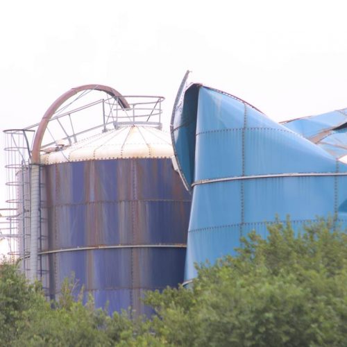
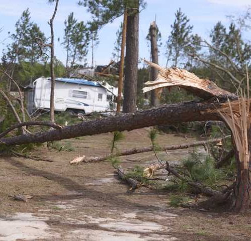
The EF-2 tornado that touched down the night of March 14 in Elmore County was spawned by a supercell thunderstorm that formed in a weather radar gap in west central Alabama.
The same storm was responsible for tornadoes in Marengo, Perry, Dallas and Autauga counties as it tracked across the midline of the state, before the twister packing winds of up to 120 miles per hour touched down in Elmore County.
The western Alabama gap is among dozens of Doppler weather radar gaps across the country.
Buddy Hill, of Marengo County, road out the storm in a shelter behind the family home.
“I’m probably like a lot of other people, I don’t pay as much as much attention to a tornado warning as I should,” he said. “The weather that evening got rough, so I went to the shelter. I’ll pay more attention from now on.”
To be clear, the region was under tornado warnings at the time the storms touched down on March 14. Central Alabama’s primary weather radar coverage comes from National Weather Service radars at Maxwell Air Force Base in Montgomery and the Shelby County Airport. Secondary coverage is provided by weather radars at the Army’s Fort Rucker in Ozark and NWS sites in Mobile and Jackson and Columbus, Mississippi.
The problem arises as you get farther away from the radar sites. After about 80 miles or so, the radar can’t “see” into the storms at lower altitudes. The curvature of the Earth cuts into coverage away from the sites, and mountainous regions also restrict coverage at lower altitudes. The western Alabama gap, covering an area west of Selma, through Meridian, Mississippi and then into eastern Mississippi, has radar coverage above 6,000 feet.
Areas closer to radar sites have reliable coverage down to 4,000 feet, depending on location.
“We want to know what is going on closer to the ground with severe thunderstorms,” said Chris Darden, meteorologist in charge of the NWS office in Birmingham. “The radar data can show us if there is rotation at the lower levels. It gives us vital information on whether or not to issue a tornado warning for an area.”
Being closer to radar sites allows NWS meteorologists to better determine if a tornado is on the ground, and issue advisories warning the public that danger is imminent. That’s what happened with the March 3 Lee County tornado, a monster EF4 packing winds of up to 170 miles per hour. The storm left 23 people dead in its wake.
The Lee County storm led to the rare issuing of a “tornado emergency” based on radar data as well as confirmation that the tornado was on the ground from first responders and storm watchers.
Watford City, N.D.
On July 10 an EF2 tornado struck the tiny town of Watford City, North Dakota, just after midnight. The area was under a severe thunderstorm warning, which carries the advisory that tornadoes were possible, but it wasn’t under a tornado warning, said John Paul Martin, meteorologist in charge of the NWS office in Bismarck, N.D. The office covers western North Dakota.
Watford City is in a radar coverage gap. The tornado, packing winds up to 127 mph, touched down about 12:15 a.m. and was on the ground for only a half-mile before dissipating, NWS data shows. But it struck a recreational vehicle park. There were 28 people injured in the storm and a 6-day-old newborn boy was killed.
The storm came from eastern Montana, through a radar coverage gap that had coverage above 10,000 feet. Watford City is about 140 miles away from the nearest radar site.
Plans are in the works to “lower the beam,” of the radar site in Bismarck, N.D., Martin said. That would improve coverage in the gap area, but not completely solve the problem, he said. Local governments are also working to purchase a weather radar unit and site it in the gap area.
“That would be a tremendous help,” Martin said. “But we have to work with the local governments to make sure we have data from that site. Otherwise we won’t be able to gain access to that data to issue warnings.”
And weather radar sites aren’t cheap. A 2008 report by the National Research Council estimated that it would take $10 million to put in a new weather radar site. The tab includes the radar unit and land acquisition. And keeping the sites up and running is also expensive. It takes about $500,000 a year to maintain each site, the 2008 study shows.
The radar network across the country is called NEXRAD, for Next Generation Radar. There are 160 sites covering the 50 states, with seven sites in Alaska and four in Hawaii. Most of the sites are are operated by the NWS, but the Department of Defense also maintains and operates weather radar sites on military installations.
In a perfect world, a new weather radar sited near Meridian, Mississippi, would address the western Alabama/eastern Mississippi gap.
But steps are being made to address the zone. Much like in North Dakota, plans are in place to “lower the beam,” of the Jackson, Miss., radar. The approval process is ongoing and should be completed by the end of the year, said Bill Parker, meteorologist in charge of the Jackson office.
“We would love to have as much data as the available tools will allow us to have,” Darden from the Birmingham NWS office said. “The farther away from a radar site an area is, the harder it is the detect tornadoes, especially those small, quick spin up tornadoes.”
And forecasters will be busy in the coming weeks.
March is the beginning of spring severe weather season in Alabama, a period lasting through May. From 1950 to 2018, there have been 293 tornadoes confirmed in the state in March, compared to 493 in April and 234 in May, National Weather Service data shows. Not to be outdone, we see another spike of severe weather in the fall, with 275 tornadoes confirmed in November for the same time period.
And while tornadoes can occur anytime, the most likely period for them to occur is noon through 7 p.m., weather data shows. From 1950 through 2018, the most common time for tornadoes to strike is 5 p.m. with 202 tornadoes confirmed, compared to 175 cyclones during the 4 p.m. hour.
During the time period, there have been 41 tornadoes confirmed in Elmore County, 40 in Montgomery and 35 in Autauga counties.
For the time period, the most tornadoes confirmed were in 2011 with 145. The least was two in 1950. There were 46 tornadoes confirmed in 2018. For a 10-year average, there were 60 tornadoes confirmed in Alabama.
by Marty Roney (2019, April 12) Montgomery Advertiser


