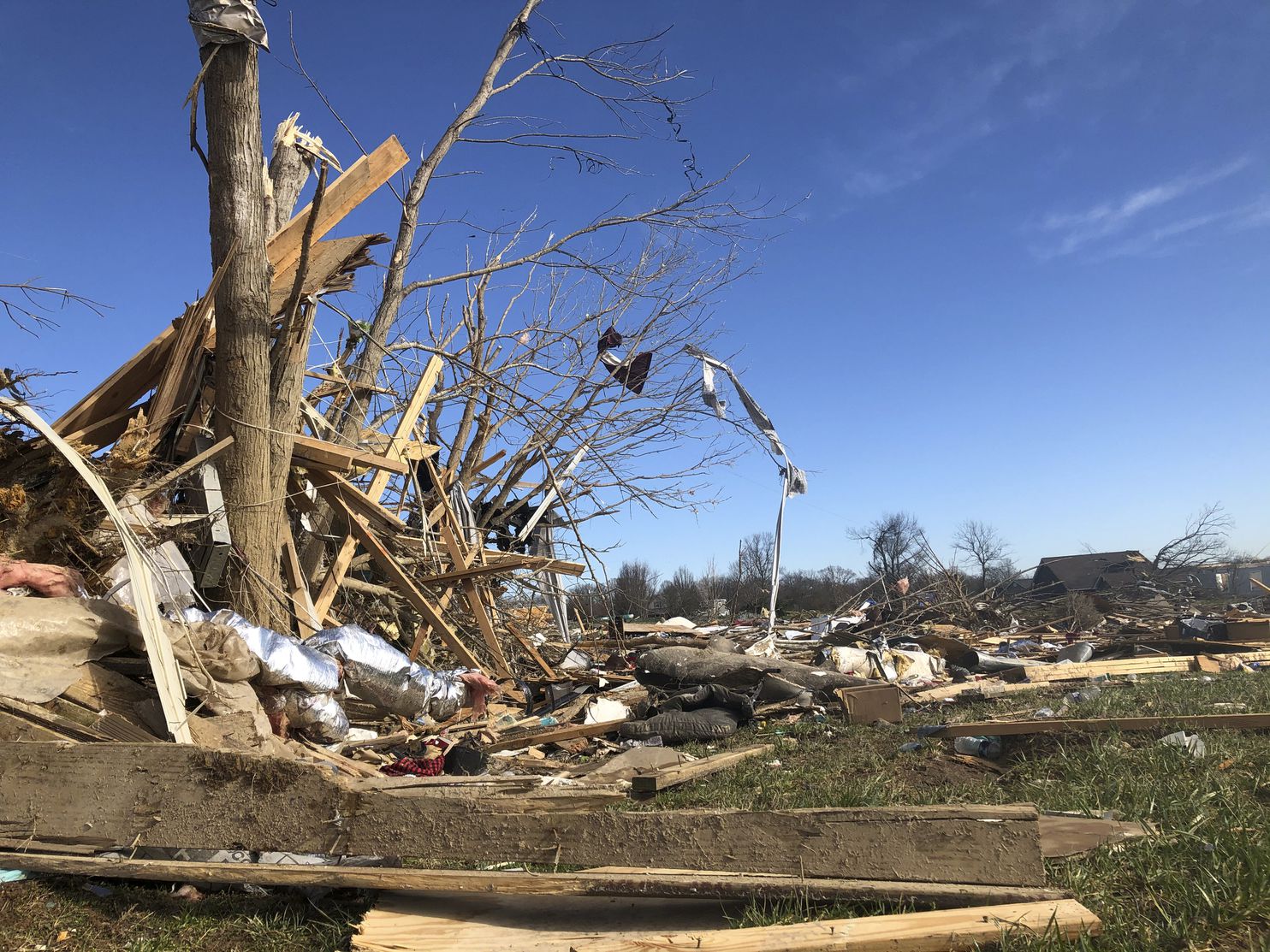
At least 24 are dead in the wake of Tuesday morning’s terrible Tennessee tornadoes. They carved a long scar across Middle Tennessee in the dead of night, racking up a large death toll in the process.
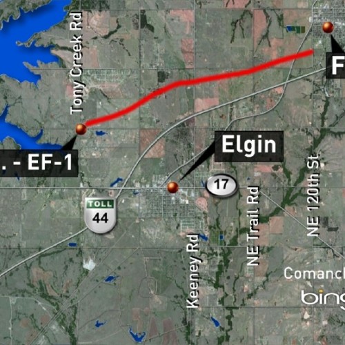
While downtown Nashville was hit hard, the town of Cookeville — about 80 miles east of the state capital — suffered the worst of the devastation. The staggeringly high casualty count and surprise violence of the tornado culminated into a potential worst case scenario amid an incredibly difficult forecast. Through the rubble, the question must be raised: What factors may have led to the disaster that ensued?
Time and time again, meteorologists criticize headlines that use phrases like “it came without warning.” Most of the time, adequate warning precedes a significant threat. But once in a while, that may not be the case.
By no means did the Monday forecast have the “look” of destructive tornadoes. In fact, the tornado threat appeared to be “isolated” at best. Things changed in a hurry once the sun set. But did the messaging — and warning process — keep up? And were residents prepared for a violent tornado striking in the middle of the night? The answers are uncomfortable.
Monday’s forecast
On Monday morning, the National Weather Service’s Storm Prediction Center placed Nashville in its “slight” risk zone for severe weather overnight into early Tuesday. Cookeville appears to have been under a general thunderstorm category, where severe weather was not initially anticipated.
Nashville was listed as having a 2 percent risk of a tornado within 25 miles of the city. That is the lowest tier of nonzero tornado risk the Storm Prediction Center can delineate. Cookeville was not initially in that risk area.
The National Weather Service in Nashville tweeted that, on a 0 to 5 scale, the risk level associated with tornadoes in Middle Tennessee was a 1.
As much as 24 hours before the tornadoes, the Storm Prediction Center keyed into one “make it or break it” feature — the cap. This layer of warm air a mile or so above the ground ordinarily squashes any attempts of surface air to rise, “capping” the atmosphere and preventing any storminess from blossoming. But meteorologists knew there was a very slight chance some of this capping could dissipate just enough to let an isolated storm develop.
Nashville Weather Service forecasters sniffed this out in their Monday morning update, writing “the primary risk appears to be hail, but locally damaging winds and even a couple of tornadoes would be possible should capping erode.” It was a very low-probability but high-impact potential.
There’s a question as to whether this extremely low-chance event was adequately communicated in traditional formats to the public. While many meteorologists, including those on television, mentioned the remote chance of an isolated spin-up tornado, there do not appear to be any sources that advertised any possibility whatsoever for a higher-end EF-3 or EF-4 tornado — never mind the nation’s most intense twister in nearly three years.
A rapidly-evolving environment
As many of the evening news programs wrapped up at 10:35 p.m., an isolated severe threat overnight appeared to remain.
“Storm mode looks to become increasingly messy, with multi-cell clusters eventually forming into a broken line,” the Nashville Weather Service had written in their meteorological forecast discussion at 10:14 p.m. “Damaging winds and hail continue to be the main concern, though an isolated tornado cannot be ruled out.”
They did note that storms would have the ability to maintain themselves overnight thanks to the wind dynamics at play in the atmosphere. But the Storm Prediction Center, responsible for monitoring environments primed for tornado activity, still only had a 2 percent tornado risk drawn in Middle Tennessee. Cookeville was on the edge of even that.
At 11:20 p.m. Monday, the Storm Prediction Center issued a very small tornado watch for portions of western and central Tennessee. It included 13 counties, within which lay Nashville, but didn’t extend farther east to Cookeville. The watch came late, when many were sleeping.
The watch itself listed a 30 percent chance of 2 or more tornadoes touching down, which is comparatively low for a tornado watch; the risk of an EF-2 or stronger tornadoes occurring was described as “low.”
That watch came only after multiple tornadoes had already touched down, including an EF-2 in Carroll County, Tenn., and a killer EF-2 in Benton County. Previous watches to the west had been in effect.
Did it come without warning?
Intermittent tornado warnings accompanied that same rotating supercell thunderstorm as it moved eastward, covering 275 miles. Baseball-sized hail fell in Dickson, about 40 miles west of Nashville, shortly before midnight.
All tornado warnings for the cell were dropped at 12:15 a.m. despite pulses of strong rotation occasionally still detectable in the lower levels of the storm. At 12:11 a.m., a severe thunderstorm warning was issued for areas farther to the east, including Nashville, warning of possible 60 mph wind gusts and half-dollar-sized hail.
In severe thunderstorm warnings, the National Weather Service has the option to include a “tornado possible” tag, noting the presence of some rotation that bears watching. This was not included in the severe thunderstorm warning. Ahead of the storm lay a sleepy city of 700,000.
A possible tornadic debris signature was visible at or just after 12:30 a.m. about a mile west of the John C. Tune Airport. Data indicates debris was likely being lofted into the air at the time. A tornado warning had not been issued.
The tornado warning wasn’t issued until 12:35 a.m., at which point the tornado was in the process of heavily damaging the John C. Tune Airport. The damage is expected to cost the facility more than $90 million, not including more than 90 damaged aircraft.
Within the next four minutes, debris from the airport would be carried to a height of 20,000 feet. So much debris was in the air that anomalously high values of the radar’s signal were beamed back to the radar, producing an obvious “debris ball” at 12:36 a.m.
Residents of downtown Nashville had about 5 to 6 minutes of warning before the destructive tornado was directly overhead. The airport and places to the west were hit without warning.
Tornado warnings followed the storm until 1:30 a.m.
At 1:37 a.m., a new tornado — with 75 mph winds — touched down east-southeast of Gordonsville, about 50 miles east of Nashville. Over the next 5 minutes, it danced along a 5.88-mile track. It was never under a warning.
The rotation in the storm began strengthening once again; at 1:48 a.m., the National Weather Service issued a tornado warning for Cookeville, stating “a severe thunderstorm capable of producing a tornado was located over Baxter, or near Cookeville.”
Less than a minute later, the tornado touched down. A little under 3 minutes after that, regions along Route 70N near the Ashcroft Subdivision were slammed by the tornado, with debris visible on radar. Areas just west of Cookeville were ravaged between 1:54 a.m. and 1:57 a.m.
Western areas only had a one-minute warning, while downtown had about 7 to 9 minutes.
Warning vs. awareness
Some argue that severe-weather awareness should have been high since Nashville was included in the 2 percent tornado-risk area from the Storm Prediction Center and because the storms had a history of damage. But 2 percent risks are issued all the time; with some areas under dozens of 2 percent risks every year, it makes sense that the level of concern associated with that bottom-end tier would be very low. And the storm had not begun to produce damage until late at night.
For some, the Nashville tornado did legitimately come without warning — and was in the process of demolishing an airport before any warning was issued. Residents downtown were alerted only minutes before it struck.
Another tornado touched down and managed to caused damage for nearly 6 miles, with no warning whatsoever.
And when the tornado first touched down west of Cookeville, there were only 60 seconds of warning in the middle of the night; farther downwind, folks had more lead time. Yet 18 fatalities resulted. Why?
Even the best warnings are futile if people do not receive the warnings. For some in Middle Tennessee, warnings were not issued, while many others were likely sleeping and unaware of the threat.
Several of the tornado warnings that were issued fell short of the national average for warning lead time of around 8 to 10 minutes before the twister first touches down.
It’s obvious that awareness was an issue Monday night. Even though the forecasts ramped up in tandem with the conditions, that change in messaging came after most had retired for the night.
Wireless Emergency Alerts (WEA) via mobile phones can often disseminate a tornado warning (if one is issued), but if cell service is interrupted, there is a chance the network may fail.
According to Walker Ashley, an atmospheric scientist at Northern Illinois University, having a weather radio is key.
“The best option is to have a weather radio and program it for your specific locale. Have multiple methods of obtaining warning information,” he wrote in an email to The Washington Post.
NOAA Weather Alert Radios can be programmed to only awaken you for tornado warnings or specific alerts in your immediate area.
This is particularly important at times when awareness of an impending severe weather threat is low, especially if the potential for a threat of such magnitude was not communicated long in advance. This can be the case at night.
“People tend to be asleep or have a much greater tendency to be unaware of possible environmental cues, which in many cases are important for initiating sheltering,” Ashley explained.
Steven Strader researches severe weather vulnerability at Villanova University. He too emphasized the need to have multiple warnings.
“Nocturnal events tend to overwhelm populations, largely because most people are asleep,” Strader said. “Your sort of senses aren’t ready to go, you’re not paying attention. How you receive tornado warnings are still incredibly important.”
He emphasized that sirens are not meant to be heard indoors. “If you’re relying on sirens, you’re really behind the ball.”
Other systems of vulnerability
Strader described the difficulty of understanding what went wrong from a messaging standpoint, as it’s impossible to interview victims who lost their lives in the tornado. Even communicating with those who survived can be challenging in the immediate aftermath. But he explained that vulnerability to storms is not a one-size-fits-all element that must be taken into consideration.
“Vulnerability can be socioeconomic, ethnographic, demographic … race or ethnicity can play a role,” said Strader. “And it’s the housing structure you live in. Not all homes are built the same, and not all behave the same.”
Strader said that mobile and manufactured homes are about 50 percent more likely to succumb to winds of a given magnitude than site-built, permanent homes.
In the end, Tuesday morning’s tornadoes reaffirmed the need to have a severe weather plan that can be put into action at a moment’s notice. It’s also vital to have multiple ways to be notified — day or night — in case one method fails. And that will become increasingly important going forward as cities grow and targets continue to expand.
“Our developed footprint is rising over time. These cities are sprawling. The odds of having another event like this are rapidly increasing,” Strader said.
by Matthew Cappucci (2020, Mar 6) The Washington Post