CINCINNATI —
Heavy damage is being reported across the Greater Cincinnati area and all across Ohio after a powerful storm brought strong gusts, rain and two weak tornadoes.
Strong winds knocked out power to 11,000 people overnight in the Cincinnati area. Crews were able to restore power to almost every home by Sunday morning.
Heavy damage was also reported in Miami County, just north of Greater Cincinnati.
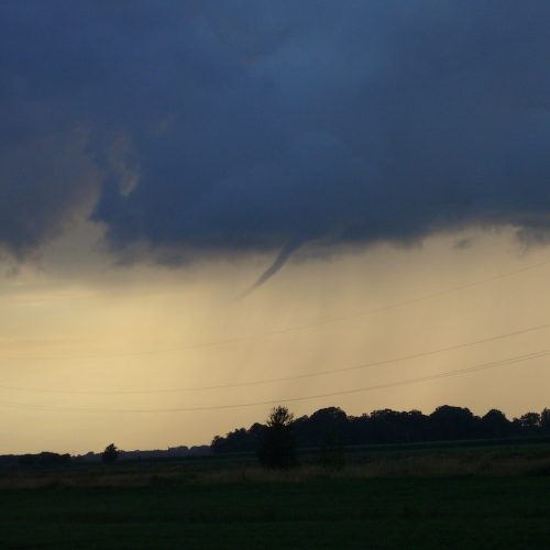
After surveying the damage, the National Weather Service confirmed two EF0 tornadoes touched down between 10 and 10:30 p.m. Saturday, one in Troy and one in Fletcher.
A weak tornado touched down in the southwest edge of the city of Troy. It crossed the city center and Great Miami River before lifting on the northeast edge of the city. The tornado was on the ground for around three miles. Another weak tornado touched down in Fletcher.
The NWS classifies an EF0 tornado as having 65 to 85 mph winds.
NWS officials said specific wind speeds, path lengths, width and timing will all be noted when conducting survey returns.
NWS officials said it appears the two are the first tornadoes of the year for Ohio. The earliest tornado of any year on record starting in 1950 was Jan. 3. in Van Wert County.
Saturday temperatures reached the high 60s in the Cincinnati area, tying a record high set 130 years ago.
A line of gusty downpours pushed across the area Saturday evening, bringing gusts of wind up to 60 mph in Greater Cincinnati and more than 80 mph at the Wright-Patt Air Force Base. That same line prompted a severe thunderstorm warning to be issued for several counties, which included downtown Cincinnati.
As the storm pulls away Sunday morning, lingering clouds will move out with sunshine returning. Winds will also continue to relax.
It will be cooler. Temperatures Sunday will start near 50 degrees around midnight, then drop off. Most of the day will be in the low to mid-40s.
Monday will be dry with more showers possible Tuesday. Despite being slightly cooler early next week, temperatures will remain 10-15 degrees above normal.
by WLWT Digital Staff (2020, Jan 12)