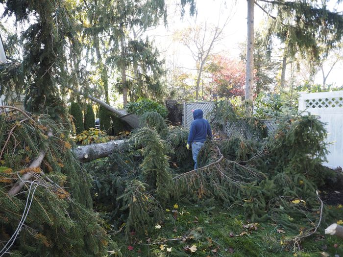
Large trees were blown down, cars were crushed, siding was ripped off houses, and downed electrical wires littered the streets of Madison in Morris County after powerful storms tore through the state late Halloween night into early Friday morning.
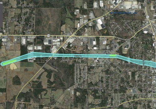
People on the ground suspected all this destruction came from the wrath of a tornado, and it turns out they were right. After surveying the damage on Saturday and analyzing radar images, the National Weather Service has determined an EF1 tornado touched down in Harding Township, raced through Chatham Township and Madison before lifting up in Florham Park.
EF1 is the second lowest on the tornado intensity scale, with these types of twisters normally packing winds of 86 mph to 110 mph. The tornado that hit Morris County had winds estimated at 100 mph and covered a discontinuous path of almost 5 miles, according to a storm survey report issued Sunday afternoon by the National Weather Service.
Madison was one of the hardest-hit towns in New Jersey, and a state of emergency was declared there after the overnight storms knocked power out to about 25 percent of all its homes and businesses, and streets were littered with toppled trees and other debris.
Some wind gusts on Halloween night reached as high as 62 mph in Sussex County, 57 mph in Cumberland County and 54 mph in Passaic and Somerset counties, according to data from the Rutgers NJ Weather Network.
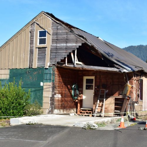
Down in Monmouth County, a large commercial building at the Monmouth Executive Airport in Wall was badly damaged by a strong burst of wind at about 2 a.m. Friday, causing walls and a bay door to collapse. Damage along Route 34 in Wall was so extensive that a stretch of the highway was closed until Sunday morning.
Meteorologists from the National Weather Service initially said they reviewed photos of the storm damage at the Monmouth airport and it appeared the destruction was caused by strong straight-line winds. However, a survey team visited the airport on Saturday and has not yet made a final determination on whether the damage came from a tornado or regular storm winds.
Thunderstorm cells associated with a very strong cold front also raced through parts of Mercer, Middlesex and Somerset counties shortly before midnight on Halloween, prompting the National Weather Service to issue a tornado warning in those counties when forecasters spotted wind rotation — one of the prime signatures of a funnel cloud — on radar.
Although the weather service confirmed an EF2 tornado touched down in Delaware County, Pennsylvania, and was part of the same storm cell that triggered the New Jersey tornado warning, they determined no funnel cloud touched down in Bucks County or in the western region of the Garden State.
New Jersey typically gets about two tornadoes each year, but had eight confirmed this year prior to the Halloween storms. Most of those occurred during a stormy weather pattern that gripped the region during the late spring and summer months.
The Morris County tornado boosts the state’s 2019 number to nine. New Jersey’s record is 17 tornadoes in a single year, 1989.
by Len Melisurgo (2019, Nov 3 | Updated 2019, Nov 4) nj.com