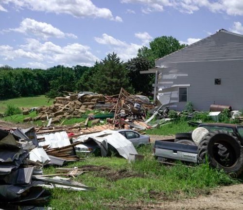
ELBERT COUNTY, Colo. – Colorado’s first tornado of 2018 was hardly impressive, manifesting as a swirl of dust in an open Elbert County field Monday.
A tornado is defined as a rotating column of air connected to the surface beneath a thunderstorm. Although condensation in the circulation often occurs and makes tornadoes highly visible, some circulations are hard to see and can only be identified once dust, grass or dirt is lifted into the air from the surface.
A thunderstorm moving out of the Denver area quickly intensified as it interacted with the higher terrain of the Palmer Divide, a hill between Colorado Springs and Denver that runs from Castle Rock eastward to the Kansas line. This hill separates the South Platter River drainage from the Arkansas River drainage.
Topping out at an elevation of 7,352 feet over Monument Hill, the terrain feature is more than 2,000 feet higher than Denver and 1,000 feet higher than downtown Colorado Springs. It’s enough to help create and enhance thunderstorms during the warm season and help produce blizzard conditions and locally heavy snow in winter.
Several storm chasers in the area verified the tornado with photos and videos. The chasers were also relaying information to the National Weather Service office in Boulder, responsible for issuing severe weather warnings and advisories for Elbert County. A tornado warning was issued for the storm at 5:10 p.m., six minutes prior to the development of the tornado. The tornado lasted about one minute before dissipating.
Visible satellite shows the storm updraft vigorously intensifying as it moved southeast across Elbert County. At the time of the tornado, the satellite shows an overshooting top, which is a protrusion of cloud through the storm’s anvil, an indication of a very strong updraft and often associated with tornado production.
by Matt Meister (2018, May 22) Fox21 News