CONNELLY SPRINGS — A survey team from the National Weather Service’s Greenville-Spartanburg office confirmed Tuesday what many folks in the eastern end of Burke County felt Sunday.
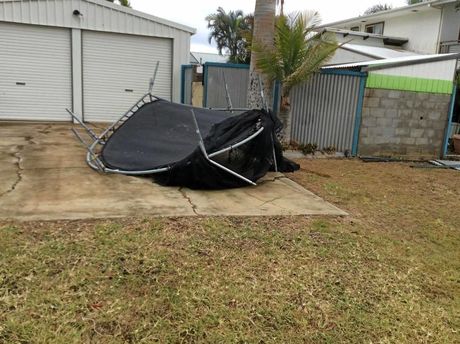
An EF1 tornado touched down near Connelly Springs on Sunday evening, the NWS confirmed in its preliminary findings Tuesday. The weather service classifies an EF1 tornado as having wind speeds of 86-110 mph. The NWS first alerted folks about the tornado around 5 p.m. Sunday when it was heading north at about 30 mph. Five buildings on Cub Creek Street were damaged, including four homes, three of which were destroyed.
Doug Outlaw, a meteorologist with the NWS Greenville-Spartanburg office, said the remnants of a hurricane and the environment Sunday evening powered the potentially record-setting tornado band that hit the Carolina’s.
“It was associated with the dissipating tropical system, Hurricane Nate,” Outlaw said. “The environment was just right. There was a band of showers and very heavy thunderstorms with the rotational wind shear within the atmosphere due to the tropical system.
“The combination of everything in the atmosphere and that environment on Sunday produced all these tornadoes. I think it may be a daily record for our office to have 13 tornado warnings in one day. We cover a total of 46 counties — 12 in South Carolina, six in Georgia and the rest in North Carolina.”
The weather service also confirmed that an EF0 tornado (65-85 mph wind speeds) touched down near Polkville in Cleveland County on Sunday evening. That storm tracked north-northeast to 1 mile inside Burke County.
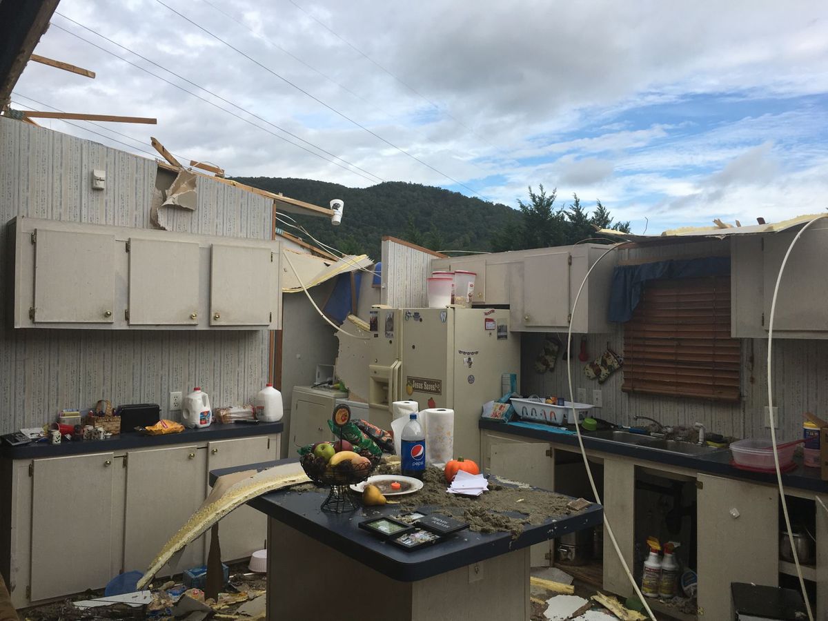
The NWS also confirmed in preliminary findings the storm that moved through Caldwell County on Sunday evening was an EF1 tornado. The Hickory Daily Record reported that 93 homes were damaged in Caldwell County due to the tornado. Eleven of those suffered major damage and six were destroyed. That tornado tracked from near Hudson southeast of Lenoir moving north-northeast to a location about 5 miles northeast of Lenoir.
Final reports and summaries for those three tornadoes had not been released as of press time.
Outlaw said Sunday’s tornado activity was the first significant weather event for the region since Hurricane Irma blew through almost exactly one month before. He mentioned those two tropical systems have produced the only meaningful rainfall in the past month.
Tuesday’s findings came after the weather service’s Blacksburg, Virginia, office reported Monday an EF1 tornado touched down in Ashe and Wilkes counties. According to the NWS report, the tornado tracked from U.S. Highway 421 just west of Harley in Wilkes County to near Idlewild in Ashe County.
That tornado lasted from about 6:45-7 p.m. Sunday evening with a maximum wind speed of 105 mph, the NWS reported. Its maximum path width was 300 yards and its path length was 6.91 miles.
“Most of the damage consisted of snapped trees, with half a dozen structures suffering minor damage, mainly along Summit Road, just south of the Blue Ridge Parkway in northwest Wilkes County,” the report summary read. “The tornado damage path was at its widest here, which was 300 yards, with most of the damage 150 yards or less.
“The tornado crossed the Blue Ridge Parkway just southwest of Elderberry Lane then crossed Phillips Gap road, downing large pine trees. The tornado lifted near Idlewild Road at 7 p.m. after snapping a few tree trunks.”
An EF1 tornado also was confirmed by the NWS on Tuesday for Tryon in Polk County on Sunday evening. That stormed touched down on the west side of Lake Lanier in Greenville County, South Carolina, before lifting and touching down again in Tryon.
by Justin Epley
October 10, 2017