Several tornadoes touched down in western Kansas on Monday, starting in Scott County and ending in Gove County, the National Weather Service confirmed.
In Scott County, a super cell moved across the area at around 7 p.m. It produced three short lived tornadoes, a report says.
The super cell dispersed along the Logan County line.
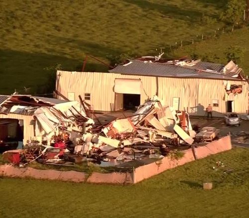
Then, in Gove County, an EF-1 tornado touched down at 7:43 p.m., traveled half a mile and stayed on the ground about a minute. Several large trees snapped in a creek bottom and a few farm structures received significant damage to the roof, a report says. Winds peaked at 95 mph.
Fifteen minutes later, an EF-0 tornado with 85 mph winds touched down for another minute, blowing over a trailer, snapping tree limbs and a residential cell tower.
At 8:24 p.m., an EF-1 tornado began at an elementary school in Quinter and damaged playground equipment. The tornado continued northeast and hit a city building, a few businesses and some single-wide mobile homes.
by Nichole Manna
October 4, 2017