The Latest on severe weather in the Plains (all times local):
A tornado struck a state prison in Southeast Texas, damaging the roofs on a pair of watchtowers and an outbuilding but injuring no one.
A prison system spokesman says the tornado struck the Pack Unit in Navasota, about 65 miles northwest of Houston, about 4 p.m. Thursday. The spokesman says all staff members and 1,200 inmates have been accounted for.
The prison houses minimum- and medium-security inmates.
About 3½ hours earlier, a tornado struck the Bryan-College Station area about 25 miles to the northwest of Navasota, causing severe roof damage to some homes and tree damage but no reported injuries.
———
4:40 p.m.
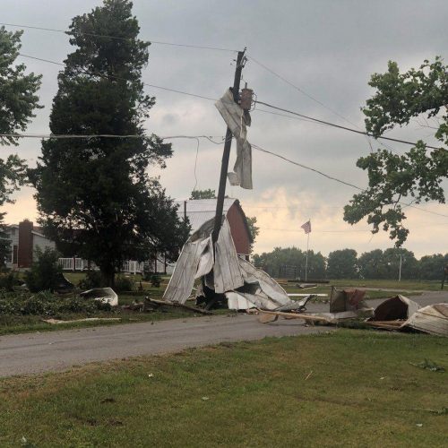
The National Weather Service says a tornado that damaged or destroyed about 20 homes near the northeast Kansas town of Chapman was an EF4 with estimated peak winds of 180 mph.
Weather service surveyors determined the tornado started at 7:10 p.m. Wednesday and stayed on the ground for 26 miles before ending around 8:40 p.m. Kansas officials said Thursday numerous power lines and a set of railroad tracks were damaged in the storm.
The twister passed just south of Chapman, a community of 1,400 that in 2008 lost more than 60 homes and had several school buildings and churches damaged by a similar-sized tornado that cut through the heart of the town.
The weather service says Wednesday’s tornado was a half-mile wide and completely destroyed a farmstead near Chapman.
Earlier Thursday the weather service had rated the tornado as an EF3.
———
4:20 p.m.
Kansas City International Airport was briefly evacuated as a precaution when a strong storm system that includes the potential for tornadoes moved through northwest Missouri.
Local media reported people were being taken to parking garage tunnels after a tornado warning was issued about 4 p.m. The airport reported the all-clear signal was given about 4:30 p.m.
There were no immediate reports of damage at or around the airport.
———
4 p.m.
Severe thunderstorms lashed much of Central Texas, causing widespread street and road flooding and spawning at least one damaging tornado.
Police say the twister struck a couple of residential neighborhoods in the Bryan-College Station area early Thursday afternoon, mangling trees and a number of roofs. No injuries have been reported, but Bryan police Sgt. Jason James says flooded roads were hampering the emergency response to the tornado.
Duck-and-cover alerts were issued for nearby schools.
The Bryan-College Station area was under a flash-flood warning Thursday afternoon, while most of the surrounding central and eastern-central sections of Texas were placed under a flash-flood watch. The Edwards Plateau and rolling plains of West Texas were placed under a severe thunderstorm watch.
———
2:20 p.m. MDT
Hail and high winds hit the Front Range of Colorado as thunderstorms moved across the Rockies on Thursday.
The National Weather Service says a storm near Colorado Springs was pummeling the area with 1-inch diameter hail. A tornado watch is in effect for eastern Colorado. No injuries were reported.
People in Washington and Yuma counties are still cleaning up from Tuesday’s storms, which produced about a half dozen tornadoes. Most of the damage was done by winds up to 115 mph and hail that pelted buildings and vehicles.
The Weather Service says the strongest twister was an EF-1 tornado that touched down near Platner in Washington County, which picked up a pole shed and carried the debris about a mile.
Other tornadoes also touched down in Adams County, near Akron and in Yuma County.
———
3:05 p.m.
Tornado warnings have started popping up across Kansas, with at least five reports of twisters touching down in the northeast part of the state.
The National Weather Service began issuing tornado warnings early Thursday afternoon and the first sighting was near the tiny town of St. George in Riley County around 2 p.m.
By 3 p.m. five tornadoes were reported in a cluster of counties in northeast Kansas, where law enforcement reported baseball-size hail that caused damage to cars and homes in Meriden northeast of Topeka.
At the same time, four counties in southwest Kansas were under tornado warnings, but none had touched down.
There were no reports of injuries or deaths in the latest round of severe weather.
———
12:35 p.m.
Forecasters say Kansas will see more bad weather as communities clean up from storms that included a tornado on the ground for about 90 minutes.
The Storm Prediction Center in Norman, Oklahoma, said there was a “moderate risk” that Kansas would have tornadoes on Thursday, including some twisters with winds above 136 mph. A strong storm Wednesday churned across the prairie near Chapman, Kansas, for an hour and a-half.
In an updated advisory, forecasters say storms will develop by mid-afternoon in southwestern Kansas and then move toward more-populated areas of the state. Some storms could also form in northwestern Oklahoma.
From Texas to Nebraska and Iowa, about 23 million people have at least a 2 percent chance of a tornado forming within 25 miles of them. In Kansas, the chance jumps to 15 percent — including in Chapman, where Wednesday night’s storm struck.
———
11:50 a.m.
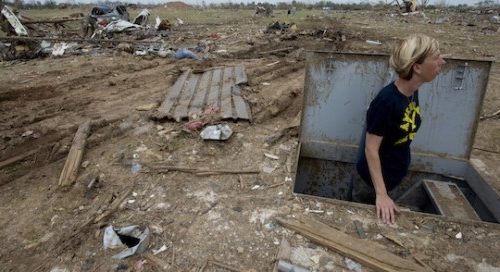
Emergency managers are coordinating volunteers to assist in the cleanup after a slow-moving tornado hit rural northern Kansas, damaging about 20 homes.
No major injuries or fatalities have been reported in the tornado late Wednesday.
Chancy Smith, Dickinson County emergency management director, told The Topeka Capital-Journal ( http://j.mp/1qLSEkM ) he is preparing telephone lines Thursday and that coordination is key because he doesn’t want people “randomly driving around looking for people to help.”
More than 120 responders searched through debris and damaged homes overnight looking for injured residents.
The National Weather Service says the tornado covered about 23 miles between Niles and Chapman in Dickinson County. Chapman is about 140 miles west of Kansas City, Kansas.
Power outages have been reported across the region Thursday.
———
6:30 a.m.
Cleanup is expected to begin after a tornado that officials say stayed on the ground for about 90 minutes damaged or destroyed about 20 homes in rural northern Kansas.
Dickinson County fire district one chief Paul Froelich told The Associated Press early Thursday that crews have completed secondary searches of the damaged properties. He says no injuries or fatalities have been reported from the tornado that swept through a 23-mile stretch of rural Dickinson County late Wednesday.
He says residents had plenty of warning ahead of the storm, which likely attributed to the lack of injuries.
He says debris management and disposal will begin later Thursday morning. In addition to cleaning up the damaged homes, crews will also have to remove scores of trees blocking rural roadways.
1:25 a.m.
Officials say a large tornado damaged or destroyed about 20 homes in a rural area of northern Kansas and came within a mile of hitting a small town.
There were no immediate reports of injuries or fatalities from the tornado that the National Weather Service said was on the ground for about an hour and a half Wednesday night.
Weather service meteorologist Chad Omitt says the heart of the twister at one point was just about a mile south of Chapman, a town of about 1,400 that was devastated by a deadly tornado in 2008 but spared on Wednesday.
Emergency crews were still assessing damage in Dickinson County and making sure everyone was OK early Thursday.
By The Associated Press
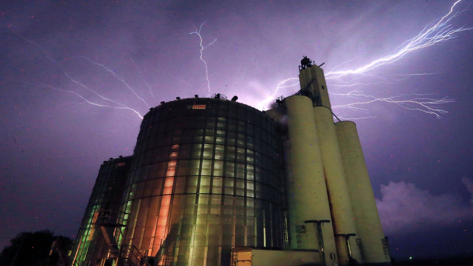
CHAPMAN, Kan. — May 26, 2016, 6:55 PM ET
Picture:Lightning from a severe storm fills the sky behind a grain elevator in Belvue, Kan., Wednesday, May 25, 2016. The storm produced tornadoes near Chapman, Kan. (AP Photo/Orlin Wagner)