A National Weather Service official on Saturday said teams were still surveying damage at sites across Middle Georgia to determine where twisters may have touched down Friday.
Areas the service was surveying included the paths of thunderstorms that rumbled across Middle Georgia on Friday morning, packing strong winds and heavy rain.
The storms generated at least one tornado near Allentown along Interstate 16 between Warner Robins and Dublin.
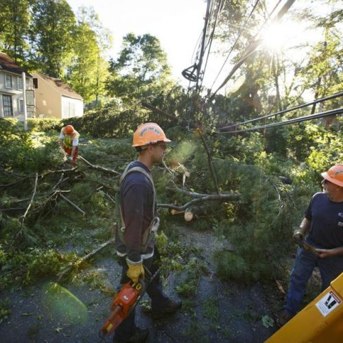
Ferocious winds, including an 83-mph gust at Robins Air Force Base, toppled trees and damaged property from Taylor County to Wilkinson County over a two-hour span beginning about 7 a.m.
No serious injuries were noted in a National Weather Service report put out late Friday.
About 7 a.m. Friday, near Reynolds in Taylor County, a camper was knocked over in high winds and several trees were blown over in neighboring Crawford County.
About 7:30 a.m., damage that the weather service attributed to “a possible tornado” included felled pine trees near Powersville, where winds were clocked at 60 mph.
Fifteen minutes later, the brunt of the storm whooshed across Warner Robins and Robins Air Force base, unleashing an 83-mph gust from what the weather service has since described only as a radar-indicated “strong rotation signature.”
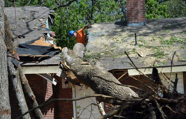
About 8:50 a.m., according to the weather service’s storm survey team, an EF-1 tornado, packing 90-mph winds touched down about 2 miles southwest of Allentown.
“The short-lived tornado was on the ground for around 1.9 miles and had a maximum path width of 300 yards,” the report noted.
Two houses were reportedly damaged on Moore Road and the report added that there were “numerous reports of structures destroyed and trees down” along Ga. 112 near Allentown.
Read more here: http://www.macon.com/news/local/article69620092.html#storylink=cpy