Lots of people move to California for its picture-perfect weather, and most of them probably don’t expect tornadoes to be part of the deal.
But the atmosphere was in a mood Monday, when a pair of rare tornadoes snaked their way down from turbulent skies in northern parts of the state’s Central Valley.
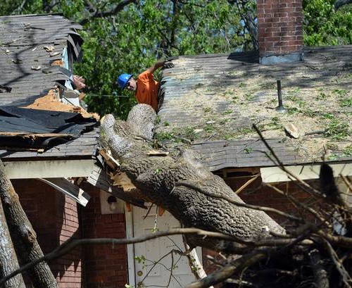
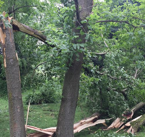
The tornadoes, one of which caused minor damage to trees, a barn and power lines, formed beneath an upper-level low, which brought a pocket of chilly air at high altitudes. They mark a set of rare Golden State twisters, as most tornadoes occur east of the continental divide.
The afternoon of wild weather made for dramatic photographs and video. The twisters occurred in Tehama County, northwest of Chico and south of Redding near Interstate 5.
The first tornado touched down around 1:34 p.m. in western Corning, about six miles west of I-5 in a rural area home primarily to farms. Downed trees were reported.
A shallow line of showers with isolated thunder showed up on radar around lunchtime, marching east through northern parts of the Central Valley. Storm tops were quite low, between 18,000 and 22,000 feet. Individual cells were moving northeast, but one taller updraft, denoting an area of stronger lift in the atmosphere, began to head southeast.
That cell then intensified slightly, building to about 27,000 feet in height. That’s when a minor downdraft, or column of cool, dry air descending toward the ground, rushed ahead of the storm and helped enhance near-surface spin.
Around the same time, a Doppler radar plot of “spectrum width,” which shows how chaotic the motion of raindrops and hailstones is within the cloud, registered a dramatic, localized uptick in turbulent motions — indicating a tornado had touched down.
That turbulence signature remained intact through the next radar scan before dissipating as the cell approached the interstate, indicating the first tornado’s circulation was present for about four or five minutes.
Around 2 p.m., downpours south of the first tornadic cell began intensifying into a spinning thunderstorm of their own, revealing a classic hook-shaped radar signature of a supercell thunderstorm. Supercells are severe thunderstorms that contain long-lasting, rotating updrafts.
The storm intensified markedly south and east of Vina around 2:30 p.m., with a rotational “velocity couplet” appearing on radar. Such a signature marks where winds were moving in opposite directions in proximity and are a telltale sign of a tornado. Radar once again depicted a column of significant turbulence, suggestive of a tornado developing or in progress.
The National Weather Service in Sacramento issued its first tornado warning at 2:38 p.m. and reported that the second tornado touched down at 2:40 p.m.
Another tornado warning was issued downwind in Butte County at 3:35 p.m., but no tornado was reported.
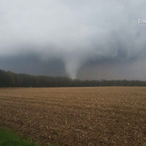
A video posted to social media captures the second tornado near Vina. Note the localized cloud-free area feeding into the tornado from the left. That’s the “clear slot,” a push of dry air, that wraps around the circulation and helps tighten it into a tornado.
In the background, strips of clouds can be seen, highlighting shower development nearby.
Tornadoes in California are not unheard of. The state averages a dozen or so tornadoes per year, most of them quick-hitting and weak. Most form in the Central Valley, where low-level southerly winds are accelerated up the length of the valley. That helps give a natural boost to wind shear, or the change of wind speed and/or direction with height, a vital element needed to spark rotating thunderstorms.
Any such supercell storms that develop in California are usually low-topped and shallow, significantly smaller than their Great Plains counterparts. Under the right circumstances, tornadoes can occasionally develop under a mere rain shower in California if it’s got sufficient spin.
The state’s strongest tornado on record was an EF3-equivalent fire tornado that accompanied the Carr Fire in Redding in late July of 2018, an hour north of Vina.
Storms in California do occasionally rival those of Tornado Alley. In May of 2019, the same area experienced a mesmerizing low-precipitation supercell thunderstorm that prompted tornado concerns as it whirled over the interstate.
by Matthew Cappucci (2021, Jan 5) The Washington Post