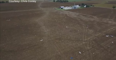
An EF1 tornado briefly touched down north of Rushford late Tuesday night causing minor damage as it tracked roughly five miles northeast through Hart Township and across I-90, the National Weather Service in La Crosse confirmed Wednesday.
According to the weather service and confirmed by Winona County Management coordinator Ben Klinger, shortly before 9:15 p.m. Tuesday, radar reports indicated a tornado had touched down in southern Winona County.
Minutes later a tornado warning went into effect, and sirens sounded throughout the county. The heaviest part of the storm appeared to stay south of the city of Winona before it crossed the Mississippi River and into Trempealeau County.
National Weather Service meteorologist Dave Lawrence said investigators believe the tornado produced sustained winds of 90-93 mph, causing minor property damage along its path.
According to the NWS, an EF1 tornado indicates a winds speeds of between 86 mph and 110 mph.
Lawrence said one of the heaviest hit homes in Hart had some of its siding torn off by the winds.
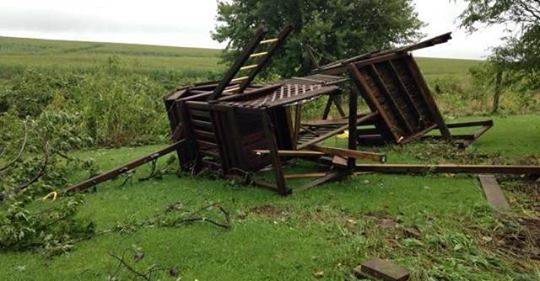
Klinger and Chief Deputy Jeff Mueller of the Winona County Sheriff’s department said they received multiple reports of downed power lines and trees as well as a photo of a toppled heavy wooden children’s playset.
There were no recorded injuries.
One commenter on Facebook said that there was a “big line of debris and a power line snapped” near her home in Hart.
In a Facebook message to the Daily News, Hart resident Miranda Jacques said she was at her parents’ house, also in Hart, when the tornado warning was issued and the house lost power. She said there was a lot of debris — including a downed power line — on their drive home on County Road 102, and her husband had to move bigger debris so they could drive through.
The Wilson Fire Department reported some small blowing debris and a tree down on East Burns Valley Road.
No other tornadoes were spotted, and the warning was lifted at about 9:35 p.m.
The storm brought with it quite a bit of rain, and areas in Winona County that were spared by the heavy rains last week saw plenty of it Tuesday night.
Stockton was hit the hardest with 4 inches of rain over a 24-hour period ending at 10:15 a.m. Tuesday. Other rainfall totals included 3.9 inches in Minnesota City, 3.5 inches in areas of Winona and 2.4 inches in Lewiston.
The storm dumped more rain to the west and north of Winona. Areas of Rochester received more than 6 inches of rain, while Wabasha received nearly 5 inches. In northern Buffalo County, Gilmanton was hit with 5.9 inches of rian, while Waumandee saw 5.75 inches. In Trempealeau, Arcadia had 4.5 inches of rain and Ettrick had 4.1 inches.
Roads were closed in Buffalo and Trempealeau counties as a result of flash flooding, but all major highways appeared to remain open.
by Winona Daily News staff (2018, September 5)