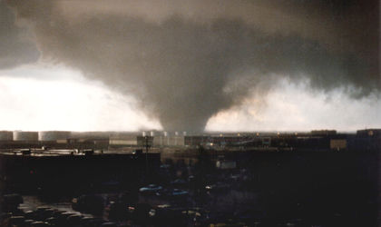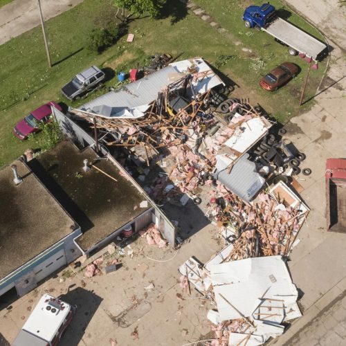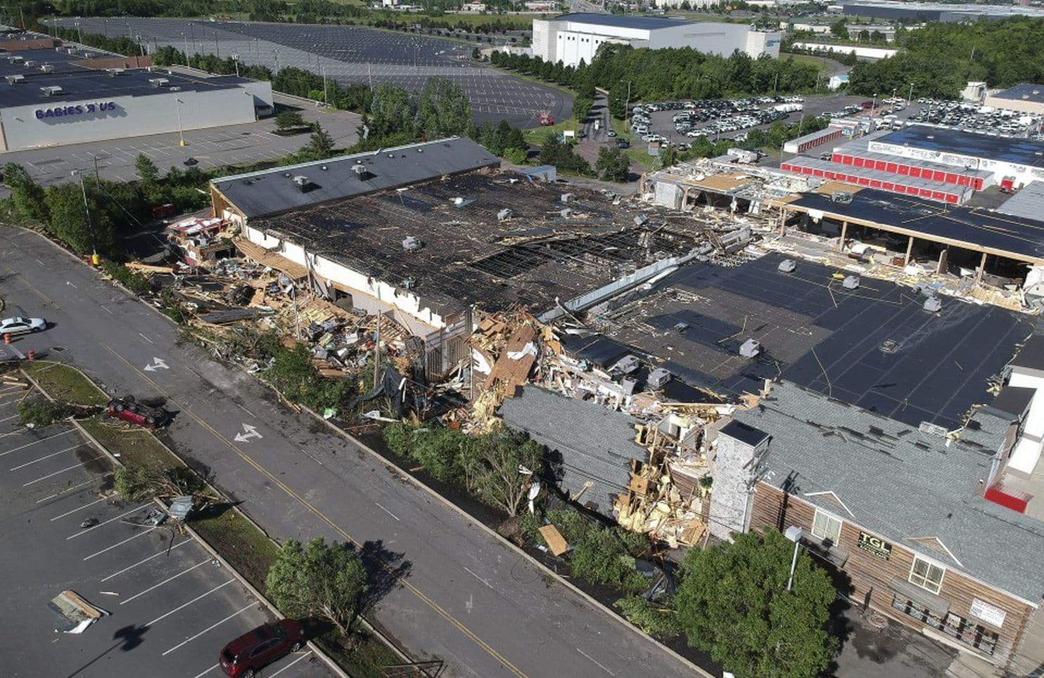
The National Weather Service in Binghamton, N.Y., confirmed Thursday afternoon that a “strong” EF2 tornado struck Wilkes-Barre Township, Pa., around 10 p.m. Wednesday. The twister sheared off structures from near their foundations, carried a store sign for miles and injured six as it carved out a path three-quarters of a mile long.
The tornado was odd in many respects, particularly in the time of night at which it occurred. Although the sun had long since set and daytime heating was lost, temperatures of 75 and high humidity (dew-point temperatures near 70 degrees) fueled storms well into the night. Of the more than 850 tornadoes recorded in the Keystone State since 1950, 2.2 percent of them have touched down between 10 p.m. and midnight.
Nighttime tornadoes are relatively common in parts of the Tennessee Valley and are considered the most dangerous because they are difficult to see coming, and they strike when people are least attuned to the weather. A study published this week found that 50 percent of people surveyed receive nighttime tornado warnings, compared with more than 80 percent during the day.
In the Northeast, nighttime tornadoes are almost unheard of. In fact, less than 10 percent occur after dark.
But Wednesday night’s twister, wrapped in rain, sneaked into the city of 40,000, presenting a particularly dangerous situation. In a stroke of good fortune, injuries were probably reduced because the twister struck a business district after hours.
“We were very lucky that this came through at 10:22, because this would be a very, very busy place at approximately 6 p.m., 7 p.m., especially on Father’s Day weekend,” Luzerne County Manager C. David Pedri told reporters.
Why was this tornado so strong?
This was a remarkably intense tornado, given how little time it spent on the ground. It took an especially perilous track through downtown Wilkes-Barre Township, plowing through Highland Park Boulevard and damaging the Wyoming Valley Mall before making a run toward Interstate 81.
The specific geography of the Wilkes-Barre area may offer clues as to why it was so intense but short-lived.
Wilkes-Barre is on the Susquehanna River in eastern Pennsylvania just southwest of Scranton. It is nestled in the Poconos, at the base of a 50-mile-long valley. While the downtown area sits at 600 feet elevation, on either side, mountaintops reach 1,500 feet or more.
Much like the funneling effect you feel between two city skyscrapers on a breezy day, the orientation of these mountains speeds up low-level “inflow” to the storm. This feeds warm and moist air — fuel — to the storm more quickly, allowing it to grow and encouraging more surface air to rise. The belt of strong winds also enhances wind shear — the change of wind speed and direction with height — and adds to the rotation of the storm.
That combination of factors spun up the tornado right as the storm arrived in the densely populated community.
Even before inspecting what was left behind, meteorologists had a hunch that the damage was commensurate with a tornado and not a microburst. As the storm blew through Wilkes-Barre, it lofted debris to nearly 10,000 feet. This is possible only with damaging tornadoes.
The debris showed up on radar as an area of “low correlation,” highlighting the jagged, rough edges of objects the radar beam bounces off. Most rain, hail and snow are rather uniform in shape, so it’s clear when something not natural — like roofing materials, wood and other shrapnel — is flying around. That shows up as a yellow patch in the bottom-left panel in the radar snapshot.
Luzerne County and Wilkes-Barre tornado history
Luzerne County has had 15 tornadoes since 1950. Four of them were classified as “significant,” rating at least EF2 status or greater on the 0-5 scale for tornado intensity, packing winds of at least 111 mph. Wednesday night’s tempest peaked at 130 mph.
Historically, Luzerne County has seen a slightly higher fraction of its tornadoes achieve EF2 strength, compared with Pennsylvania overall, possibly because of a greater moisture streaming in from the Atlantic or the effects of local topography. While 25 percent of tornadoes across the state have met the EF2 mark, 31 percent have in Luzerne County.
Although Luzerne County is no stranger to tornadoes, Wilkes-Barre has not seen a direct tornado hit as far back as National Weather Service archives go — to 1950.
The last time a significant tornado traversed the city limits was Aug. 19, 1890. That beast of a storm killed 16 — five in one home — largely in factories, an iron works and a brewery. That storm was ranked an F3. Another F3 danced along the border of Wilkes-Barre on Aug. 21, 1914, but did not come near the downtown.
June and July are peak tornado season in Pennsylvania. The state averages 13 tornadoes per year, primarily in the late spring and summer. The state isn’t immune to occasional outbreaks rivaling those in Tornado Alley, including an F5 in 1985.
Tornadoes are rarest in the wintertime — but they do happen. Northeast Pennsylvania has seen at least one tornado during the same 10-day period in February 2016, 2017 and 2018. One of these touched down in the same county as Wilkes-Barre, about 15 miles away. Even wackier is it that none of these was a “typical” supercell tornado, forming instead because of erratic wind shifts bending segments of decaying lines of storms. We call these “kinks in the line,” with the decaying cold-front storms known as “convective finelines.”
Oddly enough, Pennsylvania has historically seen far fewer tornadoes on Wednesdays and Saturdays. While this is pure coincidence, that anomalous pattern did not prove to be the case Wednesday night. Forecasters were prepared, though, issuing a tornado warning six minutes before touchdown.
by Matthew Cappucci (2018, June 15) The Washington Post