(Nebraska City) — Otoe County and National Weather Service officials are still scratching their heads over Saturday’s tornado.
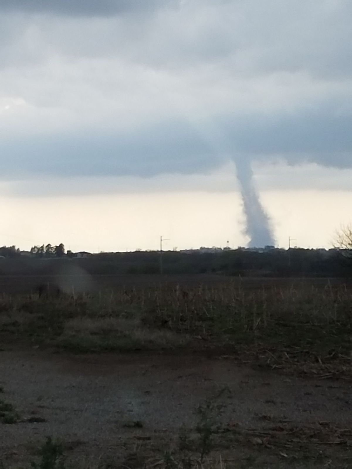
No damage was reported from the twister spotted a mile north-northeast of Dunbar shortly before 5 p.m. While the tornado was a spectacular site for motorists along Highway 2–many of whom were returning from the Nebraska football spring game in Lincoln–Otoe County Emergency Management Coordinator Greg Goebel tells KMA News the twister was mystifying, in that it left a very small path.
“The path, preliminarily, is just north of the town of Dunbar,” said Goebel. “We’re not quite sure where (it touched down). We know it was in the field. Trying to follow the damage path, talking to national weather, with what they have on their radar, it was on the ground for a very short amount of time, in a very short distance–only a couple hundred feet, or a couple hundred yards. That’s why we’re not finding any damage, or getting any damage reports.”
Goebel says weather service officials have yet to determine the tornado’s size, or whether they’ll send a team of inspectors to investigate the storm. He adds it’s fortunate the tornado was short-lived, and that it didn’t strike a populated area.
“The fact that it was on the ground, and it didn’t move very much, is a benefit,” he said, “because it didn’t put a whole lot at risk. But, it was a typical storm that we normally are accustomed to seeing. Where it touched down is close enough to the proximity of a small town that it could have done some damage. Depending on the path it could have taken to the east-northeast, it could have affected Nebraska City, and even over to Iowa–Percival and those areas.”
Weather service officials issued the initial tornado warning following a storm spotter’s report. Goebel says the storm once again demonstrated the value of a strong spotting network.
“The spotters are always the highest value that we have,” said Goebel. “National weather’s radar, as most people know, can only take cross sections at certain angles, So, the 3,000 foot down to the ground in Otoe County is generally blind to the radar. So, the spotters being out there–and actually putting eyes on the storm–is actually better than what can happen.”
Goebel says the public also helped in tracking the funnel, with reports from various vantage points.
“We had reports from Talmage,” he said. “We had reports from Sapp Brothers Truck Stop, Percival gas station, Avoca, Syracuse, Nebraska City–all different vantage points seeing this same storm. But, it wasn’t moving. So, it was very hard to determine where it was at.”
He adds Saturday’s events serve as a reminder to the public to have an emergency plan in place before the next time severe weather develops.
by Mike Peterson
Apr 17, 2017