SNOWFLAKE, Ariz. – Record-high temperatures were what everyone was talking about on the afternoon of Monday June 20. The extreme heat fueled some storms over the White Mountains but still eyes remained glued on the rising mercury.
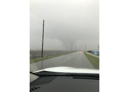
Then at 4:47 p.m., a call came in reporting a tornado about two miles southeast of Snowflake. The National Weather Service immediately issued a Tornado Warning for east central Navajo County which included the towns of Taylor, Shumway and Snowflake. Doppler radar showed the storm moving northwest at 20 mph accompanied by lightning and a drenching downpour.
The warning expired at 5 p.m. as the storm began to lose its gusto.
Following the storm came photos which the National Weather Service in Flagstaff used to help confirm the tornado. The NWS says it may make plans to visit the site and measure the damage and strength of the twister, however, the initial guess is that it was a weak one.
UPDATE: The NWS has since determined that the spinning vortex photographed was NOT a tornado but a gustnado.
Copyright 2016 KPNX
Photo: George Leech and Lorna McNeil