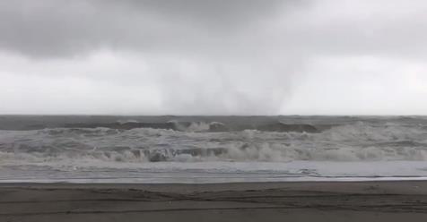
The Storm Prediction Center (SPC), indicated a severe weather and toroando threat probability for Colorado, the Panhandle of Oklahoma and Texas this weekend. The SPC was right on track. In the afternoon of April 16, 2016, unstable atmospheric conditions produced the first tornado near Eads, Colorado, in the late afternoon. Supercells continued to develop, in southeastern Colorado, and another tornado touched down near our location a bit north of Wiley, Colorado. There was also significant heavy lightning strikes associated with these tornadic supercells. The tornadic storm associated with the Whiley, Colorado tornado, also released quarter and ping pong sized hail stones, when the storm outflowed, as well.
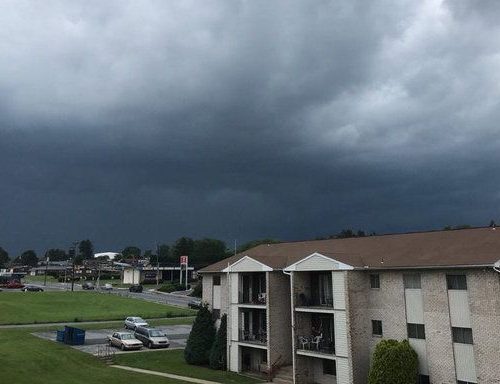
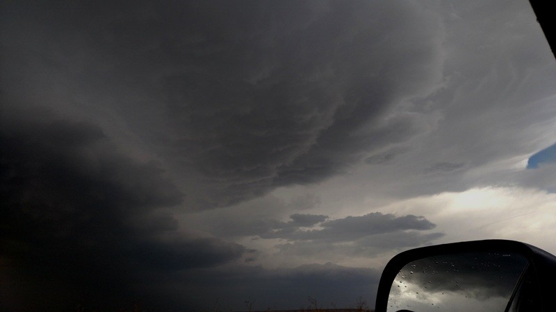
In front of the Wiley tornado to our southwest, we encountered strong inflow jets that averaged between 35-40 mph, with some inflow gusts likely exceeding 60 mph. The warm moist surface air from the southeast was drawn up into the supercell, where a 60 knot jet flow at 300mb, pushed the twisting storm motion into a northeastern trajectory. There was enough differential shear and lift to allow for rapid development of a supercell mesocyclone. At the time when severe storms formed, convectively available potential energy (CAPE) exceeded 2000, and there was a brief dry line triple point boundary near where the first tornado developed by Eads, Colorado. An isolated low pressure area in the southeast portion of Colorado expanded into a stationary front. These tornadoes were significantly large. However, these Colorado tornadoes did not hit any towns; thereby, there were no reported casualties. Today, there were multiple tornadoes in the Panhandles of Oklahoma and of Texas, as well. Storm trackers Chris Hill and Jon Merage documented these tornadic storms.
As the low pressure trough and cold front moved into Colorado’s front range, the system pulled in tornadic thunderstorms to the southeast, and behind the low to the west, winds were drawn down from the north that brought cooler temperatures and heavy snow falls to Colorado’s Front Range. Pine Cliff, Colorado got more than 50 inches of new snow overnight. Golden got nearly 30 inches of snow, while Bounder received 17 inches.
Many fruit trees had budded and where in full bloom when storms hit. Many budded trees were breaking under the heavy snow falls, and hundreds of thousands of trees lost limbs.
Chris Hill
Boulder Extreme Weather Examiner