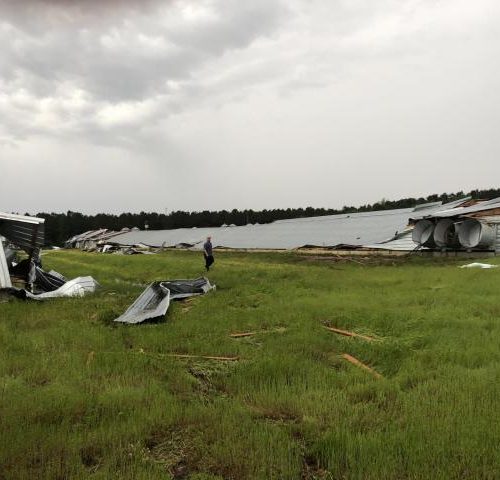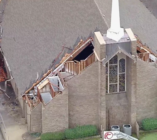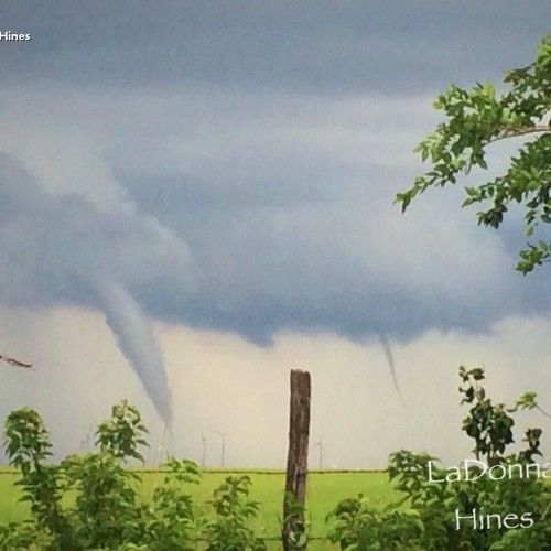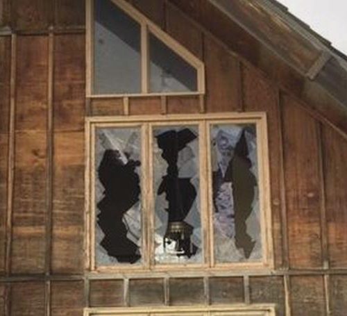
Today is the 51st anniversary of the famous Palm Sunday tornado outbreak of April 11, 1965. The picture at the top is the Swan Inn at 6 Mile Road and Alpine Avenue in Comstock Park (by Walter Nelson). A long-track F4 tornado moved from Ottawa Co. into Kent Co. – hitting Comstock Park and Rockford, then moving northeast into Montcalm Co. before completely dissipating. Here’s stories from survivors. Check out photos from the aftermath of the twister. Could it happen again? Major West Michigan tornadoes through the decades. Two F4 tornadoes struck Branch and Hillsdale Counties 30 minutes apart with 21 lives lost. One tornado had a continuous track of over 90 miles. The twisters moved across Coldwater Lake, Devils Lake, Manitou Beach and Baw Beese Lake destroying hundreds of cottages and homes. A wind instrument near Tecumseh measured a wind of 151 mph in the 2nd tornado. The loss of life would have been much worse, but for the fact that it was still too early for the summer influx of cottage owners and the fact that many residents had left for evening Palm Sunday church services. An F4 tornado north of Lansing left one person dead and there was a tornado fatality near Middleville in Barry Co. Other tornadoes that day hit north of Kalamazoo (17 injured there), near Hastings, Bay City, Unionville and 2 tornadoes struck Alma. After this event, the Weather Bureau began the Watch/Warning system that is still in use today. That year we had record snowfall (36″) and it was quite cold in March. Hail up to golfball-sized fell.
These are the path lengths of the tornadoes that day, moving through 6 states. Here’s how you can be prepared when severe weather threatens. Scientists explore changes to tornado warnings. West Michigan counties with the highest tornado count. Emergency preparedness for severe storms. Last year, Alpine Twp. printed The 50th Anniversary of the Palm Sunday Tornado book. This is a history of the tornado that came through Alpine Township on April 11, 1965. We worked with the National Weather Service on this very interesting book. It is available for $20 at the township office on Alpine Ave. and 6 Mile Road. We interviewed those who lived through that tornado and included photos of the destruction of that day.
Quick climate note. April. 1-10 was 9.4 deg. cooler than average in G.R. and we had at least a trace of snow on each of the first 10 days of April (4 days with measurable snow). The rain has ended and the fog (pretty thick in places at 8 am mainly north of G.R. and in some lakeshore areas. Places reporting thick fog at 8 am: Fremont, S. Haven, Houghton Lake and Mackinac Is.) will dissipate and we’ll become partly sunny later today. At 8 am it’s 46 in G.R., 41 at Muskegon and 37 in Big Rapids – everyone above freezing, so roads are just damp – the rest of the week looks dry with a gradual warming trend all the way up near 70 by the end of the week. We ended up with about 3/4″ of precipitation in G.R. G.R. is roughly up to 2.26″ for April and we’re now 4.81″ above average for 2016 – rivers remain high which means the water level of the Great Lakes will remain high. Only 27% sunshine so far this month…April avg. is 54%. More snow today and tonight for the U.P. Snow depth this AM: 21″ five miles NW of Ishpeming, 18″ Marquette (airport), 17″ Grand Marais, 16″ Hancock, 8″ Newberry.