Tornadoes were not part of Thursday’s forecast anywhere in Minnesota, but a supercell storm that developed during the afternooon wound up producing a rather impressive twister in southwest areas of the state.
The supercell exploded over Lyon County near Marshall and then moved east/southeast, spawning the impressive tornado near Hwy. 71 just south of Redwood Falls and north of Wabasso.
It’s unclear how long the twister stayed on the ground, or just how strong it was.
You can see more photos and videos of the tornado on the Facebook page for Redwood Falls Area Weather Enthusiasts.
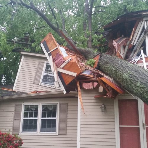
The storm went on to produce significant damage to a turkey barn just outside the City of St. James in Watonwan County, where a wind gust of 78 mph and golf ball-sized hail was reported.
What’s peculiar is that severe storms were not in Thursday’s forecast for anywhere in Minnesota. Thunderstorms were expected, but the National Weather Service never indicated any chance of a storm blowing up like the rogue cell did.
In fact, the NWS Twin Cities tweeted a simulated radar animation that showed a weak line of heavy rain with occasional thunder and lightning moving through Minnesota, just as it did, but the models never picked up on the monster of a storm developing behind the line.
It’s expected that a damage survey team from the NWS will be out in Redwood and Watonwan counties on Friday to determine the strength of the tornado.
by Joe Nelson (2019, June 21)