May 3, 1999, started like so many other days in Oklahoma. Temperatures hovered in the mid-60s, low clouds and fog hung in the air, and a stiff southerly breeze continued to drag in moisture from the Gulf of Mexico.
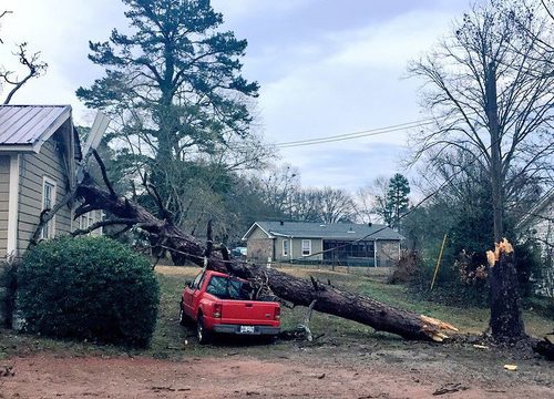
It was a stark contrast to later that evening, when parts of central Oklahoma were forever changed. Like a buzz saw scouring the ground, tornadoes brought destruction and killed 40 people.
Earlier in the day, forecasters eyed an approaching upper-level low pressure trough sweeping in from the west. It’s a setup that usually bakes up afternoon boomers along the Interstate 35 corridor — and the Storm Prediction Center had warned of a “slight risk” for severe weather.
As the morning wore on, the cloud deck began to dissipate, allowing sunlight to penetrate. That heating from below encourages air near the ground to rise as an unstable column of air, tipping the scales as a plume of moisture bubbles up. It’s a similar premise that allows pockets of fluid to ascend in a lava lamp. Recognizing the concern, the Storm Prediction Center upped the severe weather risk to “moderate,” highlighting the potential for “a few strong or violent tornadic supercells.”
What made matters worse was the presence of strong wind shear — a change of wind speed or wind direction with height. That’s not terribly unusual in mild amounts. If you’ve noticed the puffy clouds close to the ground drifting a different way than the wispy ones soaring high above, you’ve seen this in action. But if you stretch a 10-mile-tall thunderhead through these layers of varying wind, the storm will rotate ominously, spinning on its axis like a whirling top.
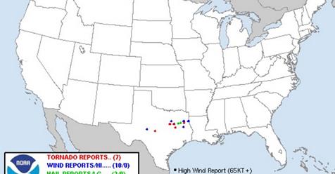
The volatile atmosphere was a loaded powder keg, as any nudge to the system could prove catastrophic. An extremely rare “high risk” of severe weather was mapped for north Texas, central Oklahoma and south-central Kansas. At 4 p.m., the first cumulus clouds shot through the “cap” (an intervening, stable air layer that prevents early storm growth) that had suppressed them all day.
Things ramped up fast. The first tornado warning in southwestern Oklahoma was issued at 4:47 p.m. At 4:51 p.m., the National Weather Service in Norman received its first tornado report. On their website, forecasters wrote that “just beyond the 5 o’clock hour, it became obvious that a significant outbreak was unfolding.” One thing soon became clear: This was a worst-case scenario setup, as a barrage of supercell thunderstorms raced toward the Oklahoma City metro area.
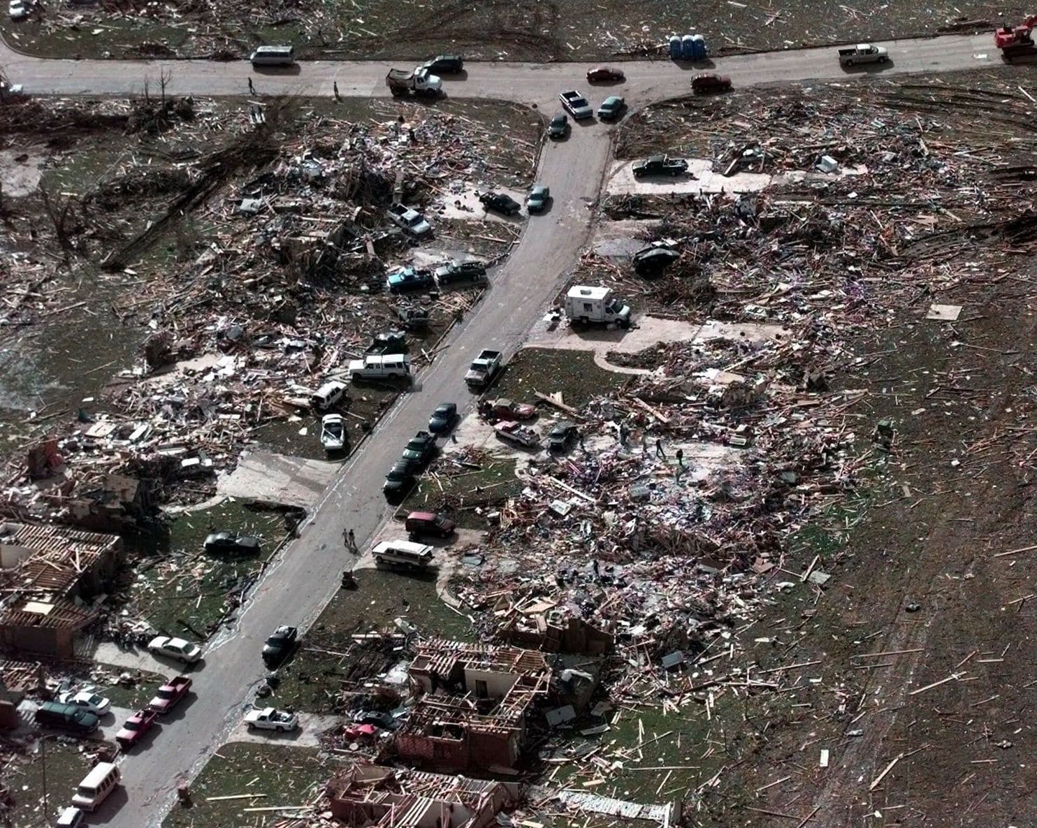
Meteorologists zeroed in on one storm, dubbed “Storm A” in an analysis that charts the endless events that transpired that day. It dropped its first tornado at 4:51 p.m. in the town of Medicine Park, about 80 miles southwest of Oklahoma City. Five other tornadoes — two of them reaching the F3 level — intermittently danced beneath the enormous mass of rotating winds at the storm’s base. From this mesocyclone came tornado No. 7 — the infamous mile-wide monster that would level a wide swath of Moore before sunset.
The twister touched down near Amber, about 20 miles from Moore. By the time it reached Bridge Creek, the magnitude of its wrath was apparent: This is where two areas of top-tier F5 damage was observed. The wedge tornado paralleled Interstate 44, its destination clear: It was heading into the heavily populated south suburbs of Oklahoma City.
Forecasters at the National Weather Service in nearby Norman knew this was a life-or-death situation, and their 6:57 p.m. message reflected it. The warning began “tornado emergency in south Oklahoma City,” the phrase “tornado emergency” never having been used before. The pioneered phrasing is now reserved only for the most significant events with the highest fatality potential, famously being issued on May 20, 2013, as another EF5 tornado barreled into Moore.
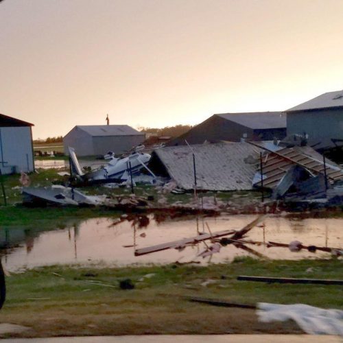
After events that happened between 7:15 and 8:15 p.m., Moore would never be the same. An airplane wing ripped from an aircraft a county away landed in the hardest-hit areas. Mobile Doppler radar probing the storm indicated the funnel contained the highest winds observed on Earth: 301 mph. Television cameras captured the heart-sinking moments as debris from homes filled the air, its parent storm cloud blotting out daylight and ushering in an early nightfall.
Thirty-six people died in the storm. About 70 other tornadoes touched down — including one in the town of Mulhall that brought tornadic winds to a region 4 miles across. This width probably includes inflow winds feeding into the voracious vortex, but by any metric this maxi-wedge was huge. The enormous tornado could have contained more than 10 of the Moore tornadoes at peak strength.
May 3, 1999, ushered in an era of tornado awareness in Oklahoma that has been called forth many times since. And 14 years later, the unthinkable happened again: Another EF5 ravaged Moore in a billion-dollar calamity.
Fortunately, today’s forecast for the beleaguered city of 61,000 is a bit more innocuous. While severe weather — including isolated hail up to the size of quarters — is in the offing, the tornado risk is quite low.
But that doesn’t mean folks in Moore won’t be holding their breath. You don’t take any chances in May in Oklahoma.
by Matthew Cappucci (2019, May 3) The Washington Post