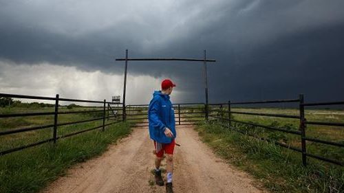
COLUMBIA — Missouri has been among the states hit hardest by severe weather so far in 2017, according to preliminary data from the National Weather Service’s Storm Prediction Center. As prime time for tornadoes begins, the data suggests the worst is yet to come.
Through May 4, Missouri recorded 555 reports of severe weather, made up of hail, thunderstorms, winds and tornadoes. That’s the second-highest rank in the U.S., with only Texas reporting more.
This is part of an above-average start to the year for severe weather across the U.S., with 6,947 incidents of severe weather reported through the first four months of the year. Comparing preliminary data, which is subject to revision and can increase or decrease slightly, that ranked as the fourth most active start to a year since 2000.
Consequences of a warm Missouri winter…
The warm winter Missouri experienced earlier this year had a large impact on the rapid start. Columbia’s average temperature of 45.9 degrees Fahrenheit in February was the warmest for the month on record, and more than 12 degrees warmer than the historical average for the month, according to the NWS.
With severe thunderstorms come tornadoes, and 2017 has also seen a fast pace in the number of tornado reports in the state thus far.
Through May 4, there were 66 reports of tornadoes in Missouri, according to the SPC. While multiple reports can be for the same tornado, actual tornado counts can increase or decrease from preliminary reports. Missouri’s tornado total for 2017 is third behind Georgia (107) and Texas (83), and data suggests a pace more than double the annual average since 2000.
Despite this data being preliminary, it’s the most accurate indicator of how many tornadoes have touched down in the Show-Me State.
While the warm weather Missouri experienced may foreshadow the fast start to the state’s tornado season, other ingredients need to be in place for tornadoes to form, according to ABC17 meteorologist Aaron Morrison. Moisture and wind shear are two of them.
Morrison said that an exceptionally warm February in Missouri this year meant that moist air coming up from the Gulf of Mexico stayed warm. In addition to this, a strong wind shear — a variation in wind speed and velocity — had been in place across the region. That meant that all the ingredients were in place for a fast start to the tornado season.
As warm weather persists, moist air continues to move up to the central plains of the U.S., including Missouri. The moist air then collides with the cold, dry air coming down from Canada and the Rocky Mountains. If there is a change in the wind shear, the two winds going in opposite directions begin to rotate and form supercell thunderstorms. If all these conditions are right, this is when tornadoes form.
This return flow of moisture has meant that Dixie Alley, Texas, and parts of the Midwest have seen the most tornado reports so far. Dixie Alley is the southeastern region of the U.S. that includes Arkansas, Louisiana, Mississippi, Alabama, Georgia and Tennessee.
The last time Missouri saw this many tornado reports through the end of April was in 2006, when there were 111 reports. That year, 143 confirmed tornadoes swept through Missouri, the most on record in a calendar year in the state, according to the National Oceanic and Atmospheric Administration’s Storm Events Database.
The average temperature in February 2006 was 34 degrees, lower than in 2017, but it unleashed tornadoes at a more torrid pace. This is evidence that warmer temperatures do not always mean more tornadoes.
The worst may be on its way…
What’s significant about this is that it’s all happened within the first week of May, the most active month for severe weather and tornadoes across the U.S. This is due, in part, to the transitional weather of spring — when the warm air from the Gulf of Mexico collides with cold air coming down from Canada. A second period of transitional weather occurs around November, but the threat of thunderstorms and tornadoes is far lower than earlier in the year.
May has historically been the most active month for tornadoes across the U.S., and Missouri has typically seen a quarter of its total tornadoes in May alone.
Dixie Alley has seen the most tornadoes of any area in the U.S., with 309 tornadoes, compared to 134 in Tornado Alley, which is historically the most active area. Missouri is not in either of these regions, but it, along with Georgia and Texas, has seen high numbers of tornadoes.
As the warm air from the Gulf moves north, it pushes the threat of severe weather northwest. When it cools later in the year, the threat moves back down southeast, in a figure-eight motion.
A second period of transitional weather occurs around November, but the threat of thunderstorms and tornadoes is far lower than earlier in the year.
The largest number of tornadoes to hit Missouri in May was in 2003, when 100 touched down.
It is May 2011, however, that stands out for Missouri residents as the most memorable tornado.
In what had already been a busy tornado season across the U.S. — 1,191 tornadoes through four months and more than 1,000 in April alone — all the conditions were in place for it to continue into May.
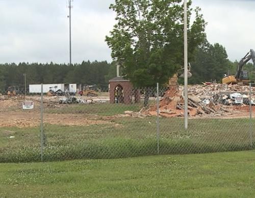
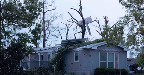
On May 22, 2011, an EF-5 tornado ripped through Joplin, Missouri — a byproduct of two supercell thunderstorms joining together. It grew up to almost 1 mile in length, killing 158 people and injuring more than 1,000, according to the National Centers for Environmental Information.
As the severe weather season approaches its peak, it’s another reminder of how a changing climate can have a deadly impact.
by Daniel Levitt
May 8, 2017