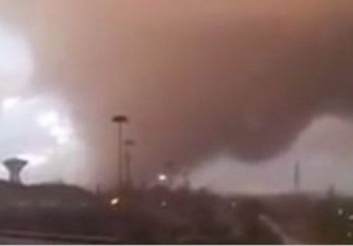
What would you do with a 20-minute warning of a tornado touchdown? Get to safety, of course, but also make sure your family gets the word if you aren’t together? Evacuate a festival, a ballgame or a playground with a sense of urgency, but not panic?
More warning means more chance to survive the scariest weather in the South. And that 20-minute warning could be coming soon thanks to scientists, engineers and technicians working with the federal government and the University of Alabama in Huntsville (UAH).
“This spring, probably not,” Dr. Hugh Christian said this week. But later this year? Maybe so. Next year? Looks even better.
Christian, 71, is a space physicist, former NASA scientist and currently leader of UAH’s lightning research group. This week, the group turned on a new lightning mapper on the International Space Station, where it was ferried this month by a SpaceX Dragon capsule. This was a “spare” mapping instrument Christian built as a backup for a mid-1990s program that sent another mapper into space.
Christian said he always expected the spare to fly, “but I didn’t think it would take 20 years to happen.”
Last November, a bigger, even more sophisticated lightning mapper went into stationary orbit over the Northern Hemisphere aboard the newest National Oceanic and Atmospheric Administration GOES weather satellite. Christian’s team had a big hand in that mapper, too.
The space station instrument will take photos of lightning as the station passes overhead – snapshots that will need meshing and interpreting. The weather satellite instrument will follow storms from beginning to end. “Now we can watch the whole life cycle,” Christian said.
Scientists know that the energy produced by serious storms jumps dramatically as they approach severe. Lightning helps discharge that energy, and a “jump signature” can be spotted when those lightning rates are moving toward their peak.
“Lightning can’t discriminate between a storm that’s going to produce tornadoes and a storm that’s going severe,” Christian said. “It can only say it’s intensifying rapidly.”
Just add Doppler
But add a Doppler radar that can see cloud rotation to a real-time lightning mapper and you have something new: a combination of tools Christian expects to increase warning time.
The detectors designed by Christian’s group can measure cloud-to-ground and cloud-to-cloud lightning. They see farther than ground detectors and allow scientists to study the relationship between lightning, precipitation and storm energy.
Beyond their predictive value for storms, Christian said the lightning mappers have purely scientific value. They will increase our “basic understanding of physics.”
Storms can produce “as much energy as an atomic bomb,” Christian said. “That’s a lot of energy. A thunderstorm is a vertical machine that helps raise that heat up higher in the atmosphere. It all works to cause a nice, stable environment.”
The lightning mapper on the space station turned on this week. The mapper on the weather satellite is already working but still in testing mode.
“There are a lot of knobs we have to go through to optimize it,” Christian said. “We don’t want forecasters to have the data before it is optimized. They get the wrong idea and think it’s not as good as it really is. We want to make sure there’s no false signatures. It’s important.”
The team will fly a third lightning sensor in NASA’s ER-2 high-altitude airplane in April to help calibrate and validate the data from the weather satellite mapper. At that time, north Alabama will be “one of the most heavily instrumented lightning research regions on Earth,” a UAH news release said.
by Lee Roop
Updated on Mar 01, 2017 at 09:30 AM CST