At 11:39 p.m. Monday, the National Weather Service in Wilmington issued a tornado warning for the small coastal community of Shallotte, North Carolina.
But the storm was already at the doorstep.
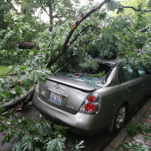
At least three people were killed and 10 injured when a tornado touched down in Brunswick County at the same time a warning was sent, forecasters and emergency management officials said Tuesday. About 40,000 people were without power and 50 homes were damaged in the Ocean Ridge Plantation area, an upscale golf and beach community.
An initial report by the National Weather Service described winds of up to 160 mph with a rating of EF3 on the Enhanced Fujita Scale. EF3 is the third-most intense rating on the scale with wind speeds between 136 and 165 mph.
“We have been talking with our partners at the National Weather Service and they were very surprised at how rapidly this storm intensified,” Ed Conrow, director of Brunswick County Emergency Services, said during a news conference Tuesday. “That’s something they normally don’t see so we didn’t have much warning and at that time of night, most people are at home in bed. It creates a very dangerous situation.”
The Weather Service issued a severe thunderstorm warning six minutes before the tornado hit at 11:39 p.m., said Mark Bacon, a meteorologist and leader of the Storm Ready program with the NWS in Wilmington. He said the thunderstorm warning came “before the (tornado’s) rotation was as pronounced.”
That warning at 11:33 p.m. would have alerted cellphones and weather radios, depending on a user’s settings, and included the areas hardest hit by the tornado.
“We’ve read several accounts on social media of people receiving them and taking cover last night,” he said.
There was, however, no tornado watch issued, which in a “normal” situation would have come around 9 or 10 p.m., Bacon told McClatchy News.
A watch indicates the possibility of a threatening weather event developing in the next few hours and often precedes a warning, which is issued when the threat is “imminent or already occurring,” he said.
The Storm Prediction Center in Norman, Oklahoma, is tasked with issuing tornado watches, which typically cover dozens of counties, Bacon said. Similar to the National Hurricane Center, it is a facet of the National Weather Service.
Warnings, meanwhile, come from one of the Weather Service’s local offices. NWS Wilmington is one of 122 local offices nationwide, Bacon said.
“A watch precedes a warning much more often than not. Usually when not it’s because small coverage of storms is expected,” he said. “Case in point last night — though the tornadoes were strong, only two counties (were) affected.”
According to the National Weather Service, the process for issuing a severe weather warning varies depending on the hazard.
Forecasters “rely heavily on observational data from Doppler radar, satellite and other ground-based equipment and sensors” for fast-developing systems like a tornado. Warnings for slower-evolving storms like hurricanes, meanwhile, are based more on numerical weather models.
“Once forecasters have high enough confidence there will be significant impacts, a warning is issued in as far advance as possible, for areas that are expected to see hazardous weather,” the Weather Service says.
Bacon said the national goal for a tornado warning lead time is about 13 minutes, while a watch is ideally issued roughly two hours before the first warning. The “storm’s unusually fast motion of 50 mph” on Monday night might have contributed to a “lessened lead time,” he said.
Though North Carolina has had a tornado every month of the year, they are relatively few and far between from mid-December to March 1, Bacon said.
Only about 25% of tornadoes occur at night, he added, but they are responsible for close to 80% of the fatalities.
by Hayley Fowler (2021, Feb 16) The News & Observer